Hiking Greenland – Icefjords and Remote Villages – Kuummiut hike
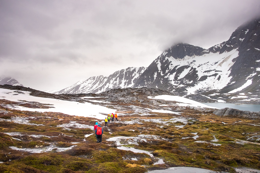
I knew the good weather couldn’t hold out forever, and Day 4 of the Icefjords and Remote Villages trip in East Greenland turned out to be a very overcast and wet affair. Oh well. The weatherman had warned us!
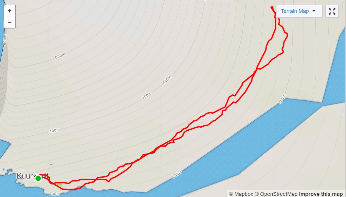
The plan for today was to hike up the Torsukattak Fjord to Illitsiartik in the Tunu fjord. This end point would just overlap with where we were hiking on Day 7 of the Unplugged Wilderness Trek last year – something that really tickled my fancy 🙂
Given the bad weather, Andrea suggested that we “start out and see how far we get”. We could always turn around and come back once we’d had enough. So we donned all our wet weather gear and headed out up the muddy streets of Kuummiut.
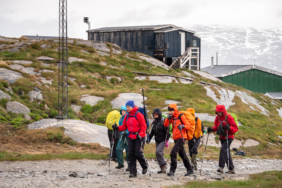
I find that with the right gear, the thought of hiking in the rain is actually a lot worse than the reality, and after 10 minutes you get used to it. Of course, if you don’t have the right gear, it can be a cold, wet and very miserable experience – see my Day 4 of the Unplugged Wilderness trek last year! Fortunately, I had learned my lesson from that hike and upgraded my gear – so I was warm and blissfully dry despite the fact that we ended up hiking for over 5 hours today!

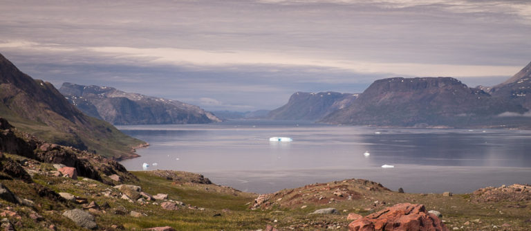
Under better conditions, it is clear that the hike would be absolutely spectacular! But on this occasion, the tops of the mountains were obscured by low cloud and we had to content ourselves with admiring their bases, the soggy ground, numerous streams and wet wildflowers that appeared along our route.

About half way along, we stopped for a bit of singing (as you do). Both Eric and Allan shared my love of singing and we had been talking about the Australian classic “The Band Played Waltzing Matilda” (I like John Williamson’s version, even though it was originally written and sung by Eric Bogle). In the end, they asked me to sing it – which I happily did, despite it being one of the saddest songs in the world.
Then Allan sang a composition of his own set to the same melody – about being an older person but still wanting to tramp around the world and not be put into a nursing home. It was absolutely brilliant! Very clever indeed. And I think all of us could relate to the sentiment – being out in the middle of nowhere in East Greenland.
Now I am an old man and I carry a pack
And I live the free life of a rover
From the Annapolis Basin to the mountains out back
And I hike the trails all overAnd I rant and I rave and I have too much fun
I’m outside all day and I drink too much rum
In the wind and the rain and the snow and the sun
And they’re not going to take me to the rest homeChorus:
So I’ll hike the trails all over
Round the lakes and the hills and the trees
And just like the deer, the coyotes and bear
I’ll live wild and ragged and freeSo I’m ragged and free and I live by the sea
And I can’t wait for the day to begin
My feet hit the floor and I’m soon out the door
‘Cause I don’t want to miss anythingI love to explore and I know there’s much more
I want to be out there till I’m 94
And I don’t care that I’m old tired and sore
They’re not going to take me to the rest homeRepeat chorus
I’m abrasive, irascible and obnoxious too
And I’m a jerk sometimes but I can’t help it
Contumacious, pugnacious and obstreperous too
And maybe I’ll change but I doubt itBut when I’m out there my heart starts to sing
I start to relax I forget everything
And after awhile I feel like a king
And they’re not going to take me to the rest homeRepeat Chorus
Note: “Hike the trails all over ” can be substituted by “Ride my mountain bike all over”
Words: Allan Rodger
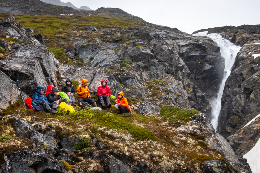
In the end, Andrea decided not to walk all the way to Illitsiartik. At a large river where we would have had to change out of our hiking boots in order to cross, she instead decided to head up towards the mountain on our left to see what fed this river in front of us. A large waterfall it turns out!

It was an impressive cascade

and a great place to enjoy a quick, damp lunch 🙂 It would be stunning in nice weather!
The weather didn’t really improve for our hike back to Kuummiut, but to be honest, it could have been a lot worse. It was just drizzling and wet. At least there was no wind to go with it!
Still, it was a relief to be back in the house in the dry and the warmth, sitting around the dining table chatting and drinking tea and hot chocolate.
And singing! It seems that Allan and Eric are very keen singers as well as being very keen Backgammon players. They have a particular interest in Arctic expeditions, and sang us a couple of songs about Franklin – one of several explorers who attempted to find the Northwest passage through the Arctic. I loved “The Northwest Passage” sung here by Stan Rogers.
Then Andrea chimed in, attempting to teach us an Icelandic round. When we struggled with getting our tongues around the words to that, she started singing “The Waters of Babylon”. This was most famously recorded by Don McLean, and is one of my all-time favourite rounds! I happily joined in 🙂
I love singing!
Dinner tonight was a thick mushroom soup, followed by spaghetti bolognaise and Koldskål – a strange Danish cold dessert of buttermilk and lemon into which you crush plain biscuits. The Danes actually have a lot of these bizarre desserts!

Here’s hoping for better weather tomorrow for our climb to the summit of Mt Kuummiut!
Read more about the Icefjords and Remote Villages Tour
If this post has piqued your curiosity about hiking and trekking in East Greenland, read about the rest of my adventure on the 10-day Icefjords and Remote Villages tour with Greenland Adventures:
- Day 1 – Kulusuk
- Day 2 – Hike to DYE-4 radar station
- Day 3 – Kulusuk to Kuummiut
- Day 4 – Hike to Illitsiartik in the Tunu fjord
- Day 5 – Hike up Mt Kuummiut
- Day 6 – Kuummiut to Tiniteqilaaq
- Day 7 – Hike near Tiniteqilaaq
- Day 8 – Tiniteqilaaq to Tasiilaq, hiking the “Sermilik Way”
- Day 9 – Tasiilaq
- Day 10 – Tasiilaq to Reykjavik
If it has sparked an interest in Greenland more generally, learn more about this amazing country at Visit Greenland, and check out the wide range of tours of all kinds (not just hiking and trekking) at Guide to Greenland.
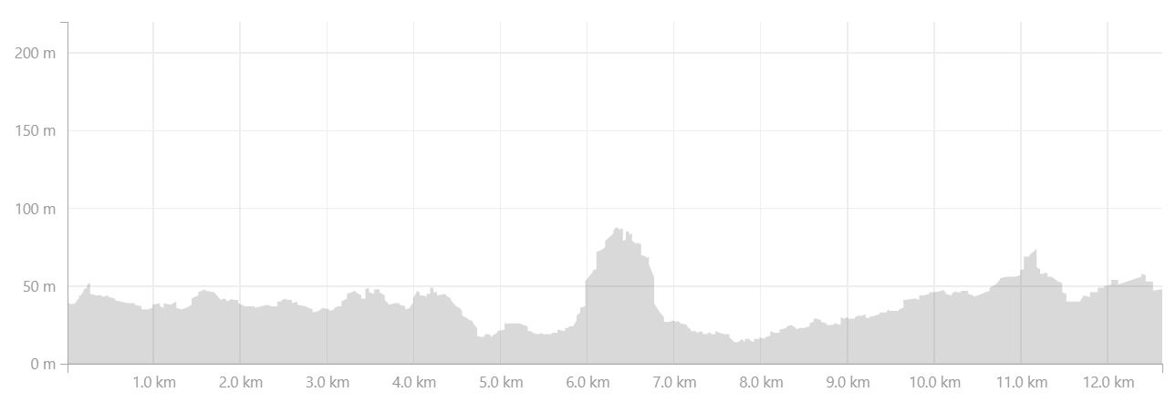
Hiking Information
Distance = 12.6km
Time taken = 5 hours 37 minutes
Strava Link = https://www.strava.com/activities/1704299546
Map
Altitude Profile
