Trekking Greenland – Arctic Circle Trail – Ikkattooq to Eqalugaarniarfik
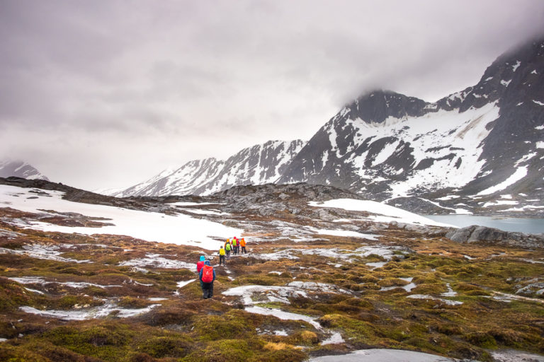
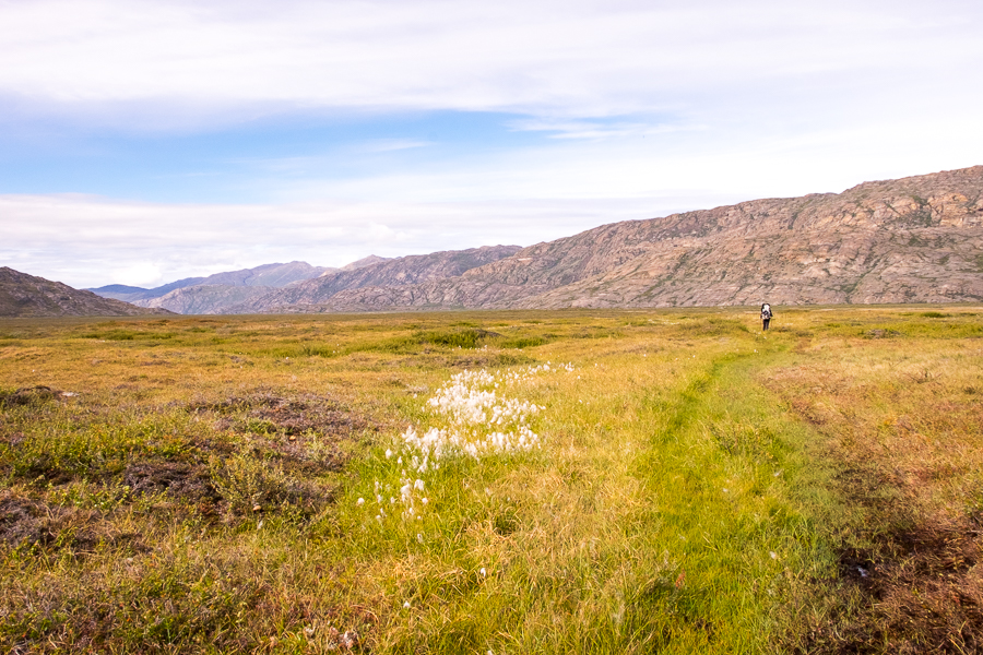
After a 24km day and a 23km day, today was a relative doddle at only 18km. We’d heard from some hikers coming the other direction that it was all downhill to the next hut. And that was true … so long as you discounted the first 2km that rose quite steeply to another ridge!

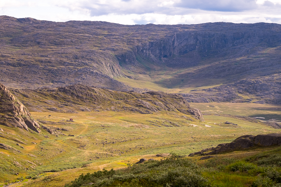
There we entered a strange landscape of large rocks and isolated boulders, presumably left in place as the glaciers retreated,
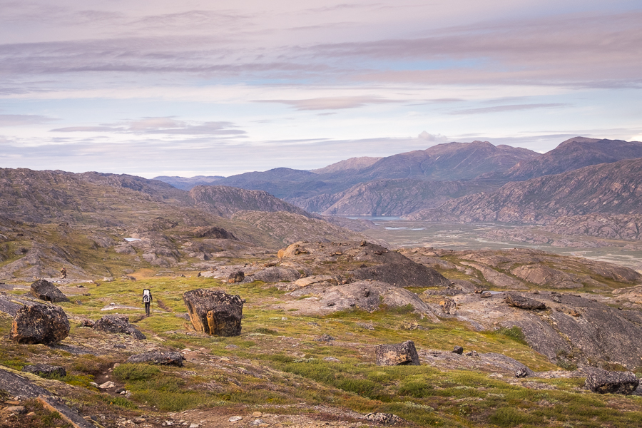
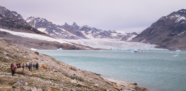
before arriving at one of the most spectacular viewpoints on the trail.

Ole’s Lakseelv (Itinneq) Valley is absolutely spectacular from this vantage point!

[move cursor over the image to see the full panorama]
We spent quite a while up here admiring the view and waiting to check in with Rob (who’d set out before us) via walkie-talkie. He told us to look for an inflatable boat about 50m upstream to help us cross the river, and that he could see some Musk Oxen (“Umimmak” in Greenlandic) further up the valley. This last piece of information was finally motivation enough to get us moving (Musk Oxen were the only animals in this region that we hadn’t yet seen), and we set off down into the valley.
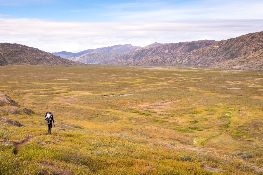
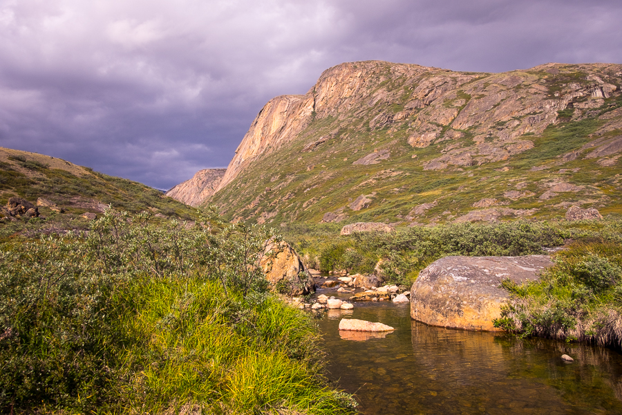
The floor of the valley was, surprisingly, no more boggy than other areas we’d already hiked through
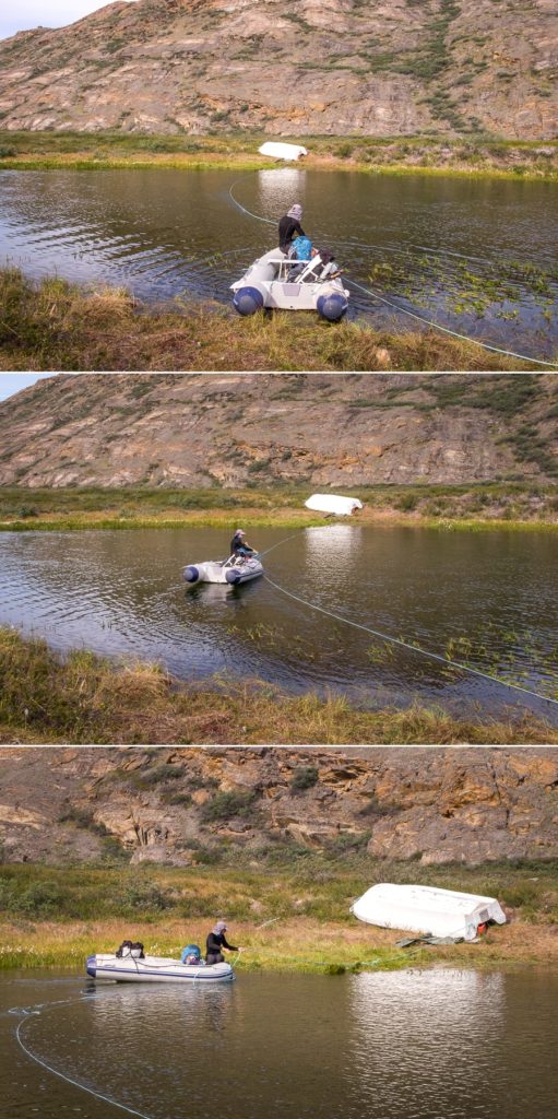
and we ended up finding Rob’s boat exactly where he told us to look for it. It took us a few minutes to sort out the exact angle of approach so that we could climb into the boat without getting our shoes wet, before pulling ourselves and our packs across with the rope.
We hiked very quickly along the other side of the valley in an effort to reach the Musk Oxen before they moved on. Unfortunately they were just a little too quick for us, but we did manage to see them from a distance and decided to have lunch on a nearby rise to see if they would come closer.
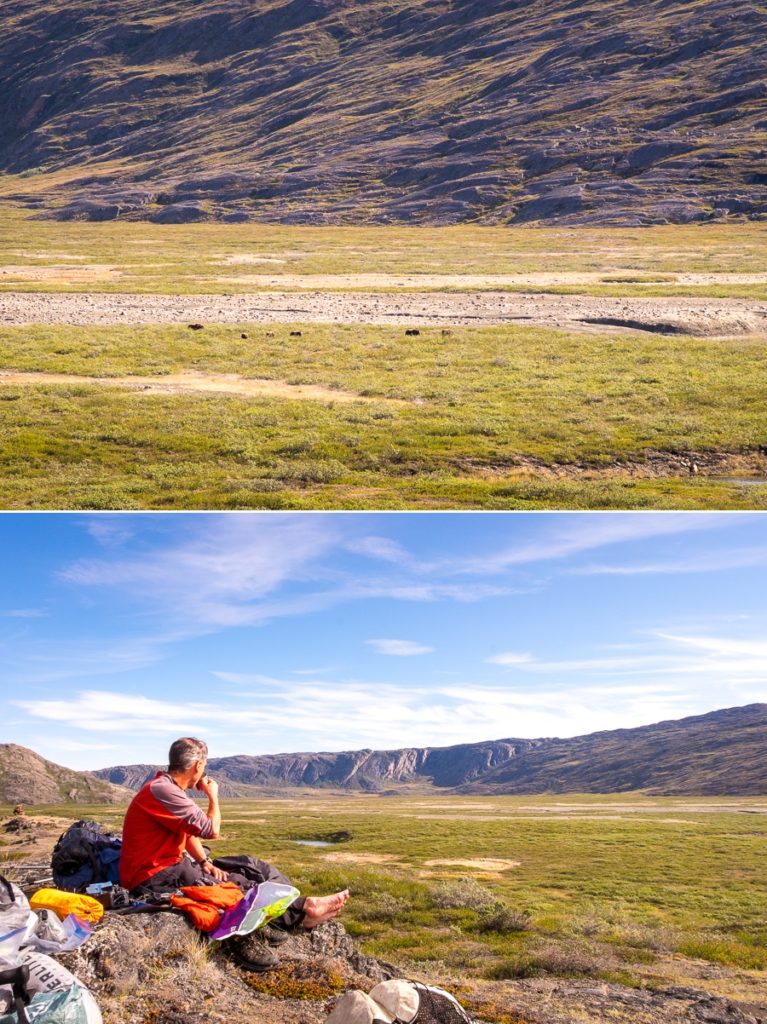
Unfortunately not 🙁 Oh well. Still some days to go…
It was at this point that we also had to have the conversation about the schedule for our hike. Rob wanted to climb an unnamed mountain the next day. Tyson and I wanted to get to Sisimiut earlier than planned to spend extra days doing day-hikes around there. In the end, we agreed to go our separate ways but keep in touch via walkie-talkie. We also made a time to meet up one last time in Sisimiut – partially to make sure Rob arrived safely, but also to say goodbye.
And then there were 2.
After lunch, Tyson and I headed out first and climbed a small pass to arrive at the Eqalugaarniarfik Hut, the next stop along the trail according to the Cicerone Guide. However, several of us last night had felt that 11km was too short a day and, in discussion with the Kiwi-Canadians, we had decided to continue for another 6km to a spot that looked like a good campsite on the map. Tyson and I were happy to go along with this plan because A) 11km is a very short day. And B) we really needed that canister of spare gas the Kiwi-Canadians had promised us 🙂 Especially since we’d given the extra canisters we’d collected to Rob.
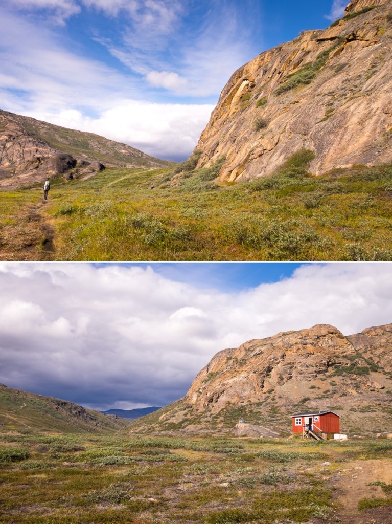
Just after the hut, we came across our first stream for the hike! Up until this point we had been drinking water from mountain tarns that form when rainwater (more likely snow in the case of Greenland) gets trapped in depressions in rock. They have no inflow or outflow, so the sudden appearance of running water came as quite a surprise.
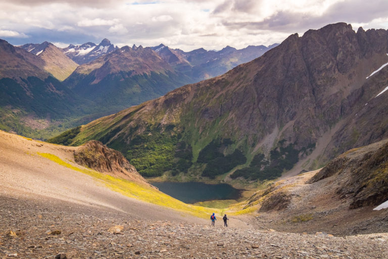
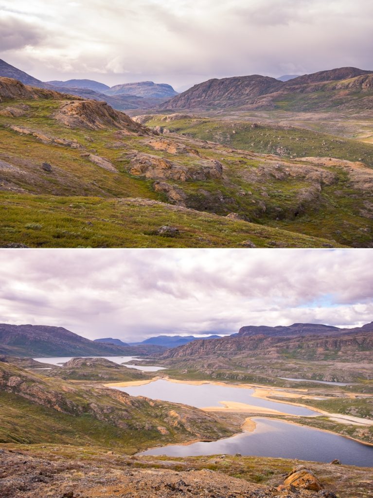
The trail then climbed fairly steeply up to another ridge
with spectacular views into the next valley lying at the base of the Taseeqqap Saqqaa range.

[move cursor over the image to see the full panorama]
It was a really beautiful hike. Another of my favourite parts of the trail.
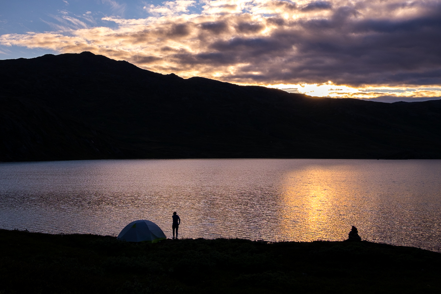
We had come across the Young Germans camped part-way along the ridge in a sheltered spot, and eventually found the Kiwi-Canadians at the base of a hill on the shore of a lake – pretty much exactly where we had planned to camp. It was an awesome spot with an amazing view, and very close to a small waterfall. We ended up camping a short distance away and gratefully accepted their proferred gas after they had finished cooking their dinner. Hot tea again tonight 🙂
Trekking Information
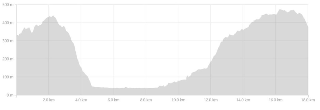
Distance = 18 km
Time taken = 8hrs 30mins
GPX File =Arctic-Circle-Trail-Ikkattooq-Eqalugaarniarfik.gpx
Strava Link = https://www.strava.com/activities/1813015213
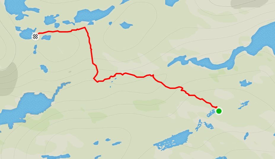
Map
Altitude Profile
Read more about hiking the Arctic Circle Trail
If this post has piqued your curiosity about hiking and trekking in Greenland, read about my adventure over 8 days on the Arctic Circle Trail:
- Day 1 – Kangerlussuaq to Katiffik
- Day 2 – Katiffik to Canoe Center
- Day 3 – Canoe Center to Ikkattooq
- Day 4 – Ikkattooq to Eqalugaarniarfik
- Day 5 – Eqalugaarniarfik to Innajuattoq II
- Day 6 – Innajuattoq II to Nerumaq
- Day 7 – Nerumaq to Kangerluarsuk Tulleq Nord
- Day 8 – Kangerluarsuk Tulleq Nord to Sisimiut
- Arctic Circle Trail Summary
Also check out the Official Arctic Circle Trail website that I created for Destination Arctic Circle, and the Arctic Circle Trail Go-to Guide at Visit Greenland for which I was the primary creator. You may also be interested in the dedicated hiking trails site for the Arctic Circle region.
If it has sparked an interest in Greenland more generally, learn more about this amazing country at Visit Greenland, and check out the wide range of tours of all kinds (not just hiking and trekking) at Guide to Greenland.