Hiking Argentina – Loma del Pliegue Tumbado – El Chaltén
Another of the key day-hikes from El Chaltén is to the Loma del Pliegue Tumbado. This seems to be everyone’s last option (the Senda Laguna Torre and Laguna de los Tres are far more popular), but the park rangers tell me that it is actually one of the most spectacular hikes … IF you have a clear day.

Unfortunately, with the exception of part of the day we hiked to Laguna de los Tres, Mathilde and I didn’t have a lot of luck with the weather ☹ Undeterred, we headed out anyway to chance our luck on things improving in the 3 hours it would take us to reach the viewpoint.
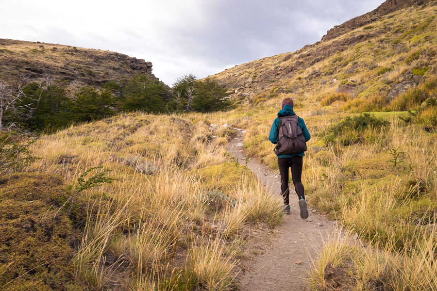
This hike is quite different to the others in that there are not many mountain views until you have gone quite a long way. Rather, it is a steady and surprisingly steep uphill climb through Patagonian grasslands and then Lenga forest
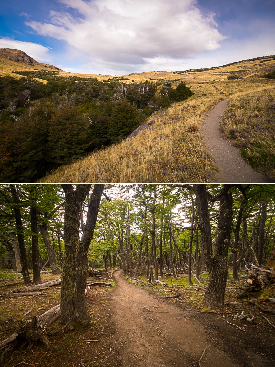
until you arrive at the first real viewpoint about 2 hours later.

Hmmm… our hope that the clouds would lift did not look like it was going come to pass.
Nevertheless, we had walked this far, so we figured that we might as well hike the final 40 minutes to the actual viewpoint. This part of the trail is very exposed and takes you across bare, rocky ground, usually fighting an incredibly strong wind. Fortunately, on this day, the wind was very mild – perhaps part of the reason the clouds were still lingering on the mountains!
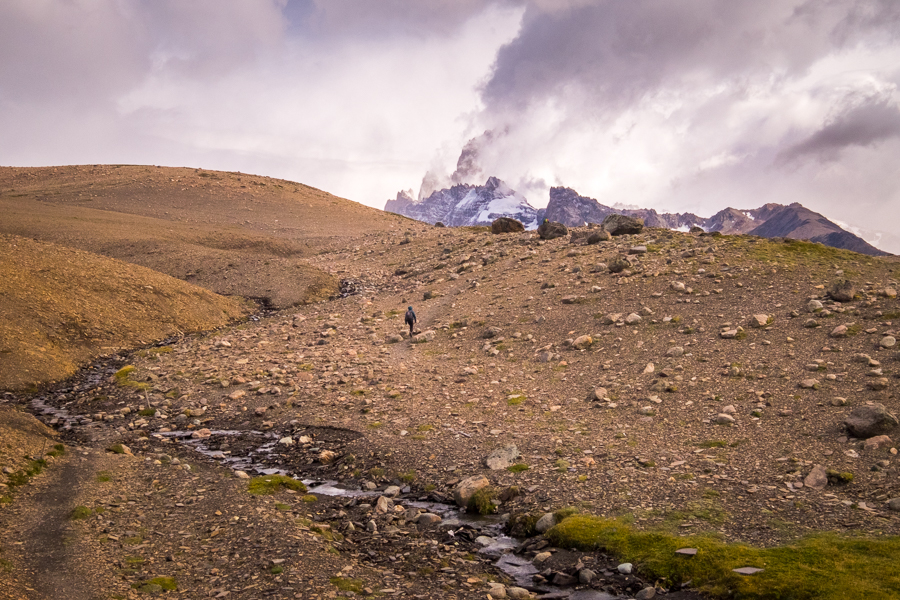
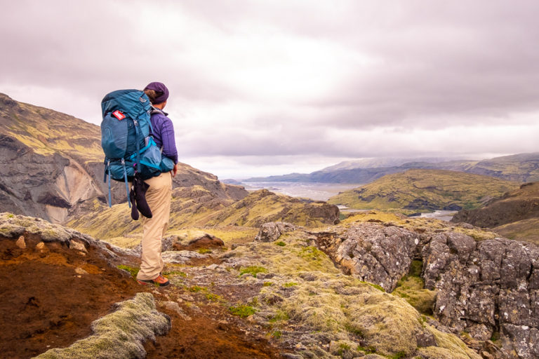
We reached the top and headed down for what view we could get over the mountains, lake and glacier. In fact, it looked almost identical to when I did this hike in 2015!

The difference this time was that I got to share the frustration and cold with a friend 😊

Pictures taken, it was time for a fancier version of my regular day-hiking lunch (in place of salami, I had prosciutto in my cheese and processed meat sandwich!) Previous hikers have built several rock walls to try to gain some protection from the normally fierce winds that blow across this exposed hill – so Mathilde and I (and several other new friends) hunkered down behind one of these to eat.
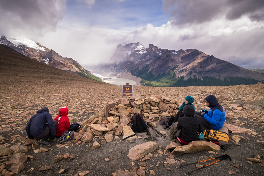
In 2015, I think I lasted 10 minutes, even with the protection of the rock wall. This time, Mathilde and I managed to enjoy the views from the Loma del Pliegue Tumbado for about 45 minutes before the cold and the worsening cloud cover drove us back towards El Chaltén.
But we did have one fantastic surprise along the way! A woodpecker doing his thing 😊

I guess I’m just going to have to come back again to do this hike, as I’m really curious to see the amazing view described by the park rangers.
Recommendation
The Senda Loma del Pliegue Tumbado climbs higher than the Laguna Torre hike and the Laguna de los Tres hike. For this reason, the park rangers don’t recommend it if the day is forecast for wind or rain. If you get a nice day, however, they say it is an incredibly beautiful view from the end.
Distance: 20km return
Time: 6 hours