Hiking Greenland – Russell Glacier
It was quite difficult to tell how many days I should allocate to exploring the area around Kangerlussuaq before starting the Arctic Circle Trail trek. There seemed to be a fair few options for things to do – the Russell Glacier, visiting the Greenland Ice Sheet at Point 660, Sugarloaf Mountain, Garnet Rock, a wildlife safari – and in the end, I decided on 2 days at the beginning and 2 days at the end. Unfortunately, this was curtailed to 1 day at the beginning (thanks to Air Iceland Connect dropping their direct Reykjavik-Kangerlussuaq route) and no days at the end (thanks to being stranded in Sisimiut due to bad weather) – so the only activity I managed was a trip out to Russell Glacier with Kang Mini Tours.
Our guide, Tommy, arrived at Old Camp to pick me up at the agreed time, and off we headed up the gravel road. Running approximately 53km from Kellyville to the Icesheet, it is the longest road in Greenland and accounts for around 1/3 of the road infrastructure (outside of the settlements) in the country!
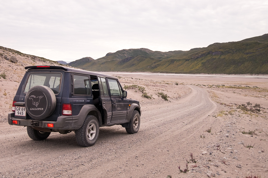
It was originally constructed to give access to the icesheet so that Volkswagon could test their cars under extreme cold and almost zero traction conditions. However, this activity no longer takes place and it now provides inexpensive access for scientists studying the ice as well as for tourists wanting to visit the world’s second largest icefield and the Russell Glacier.
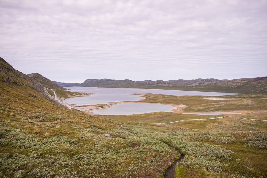
As we followed the meandering Akuliarusiarsuup Kuua river (more commonly known by its Danish name: Sandflugtdalen), Tommy told us some of the history of Kangerlussuaq, kept a keen eye out of wildlife – particularly Musk Oxen – and also explained a little about the geology and botany of the area.
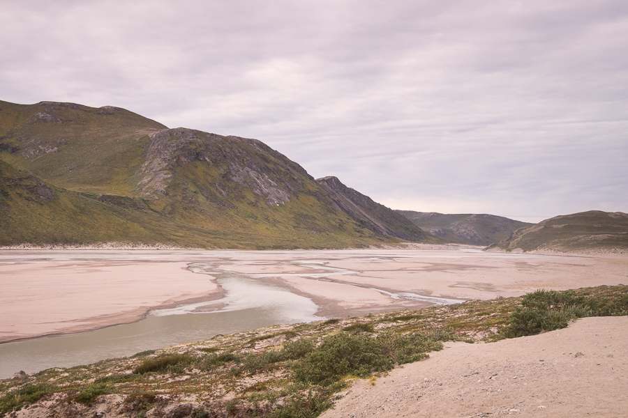
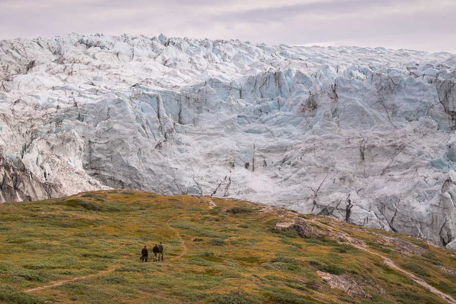
Our jeep ride ended just past the locked boom-gate at the end of Aajuitsup Tasia lake, and we followed a trail up and over the ridge
for our first view down onto the Russell Glacier itself.
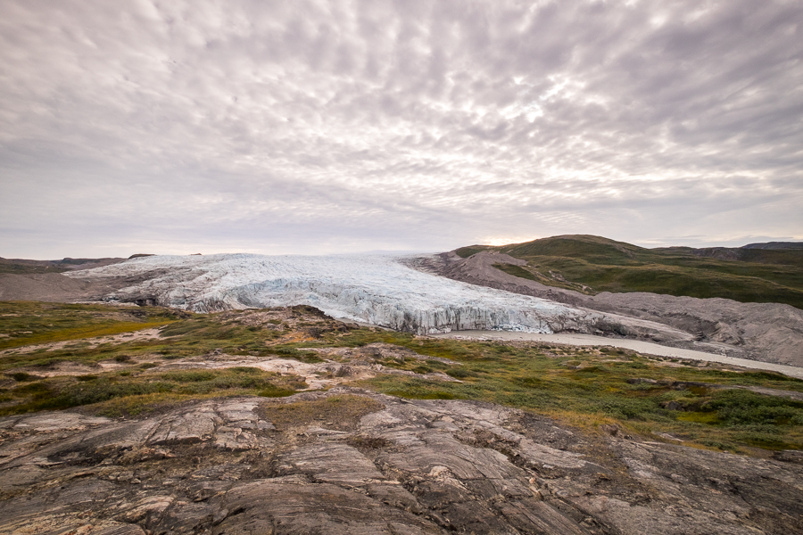
Words cannot describe the shear magnificence of glaciers, and even though I’ve seen a lot of them in my travels both here in Greenland and also in Patagonia, I never tire of their intricate beauty.
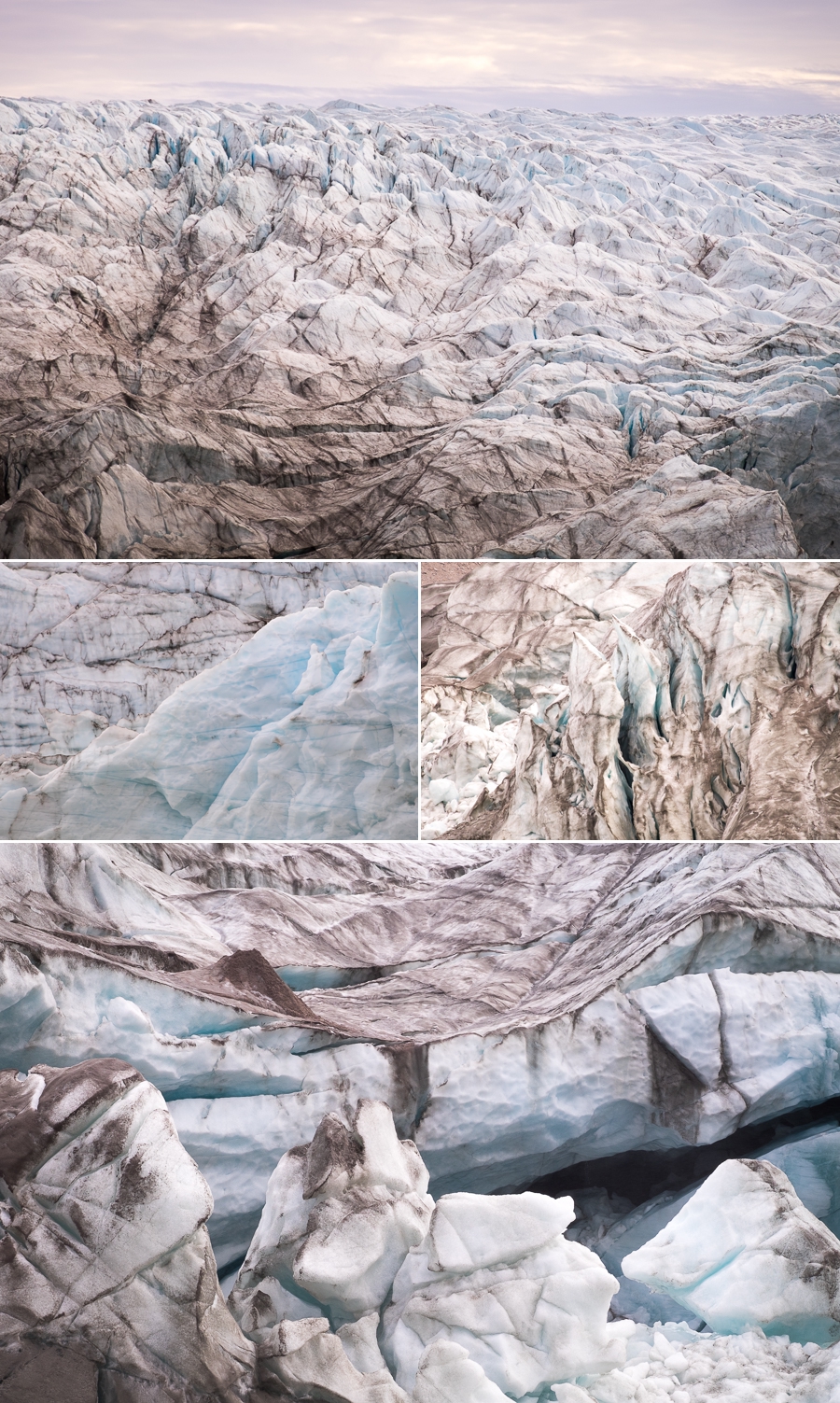
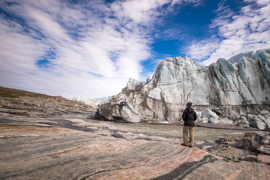
One of the incredible things about the Russell Glacier is just how close you can get to its 60m-high face.

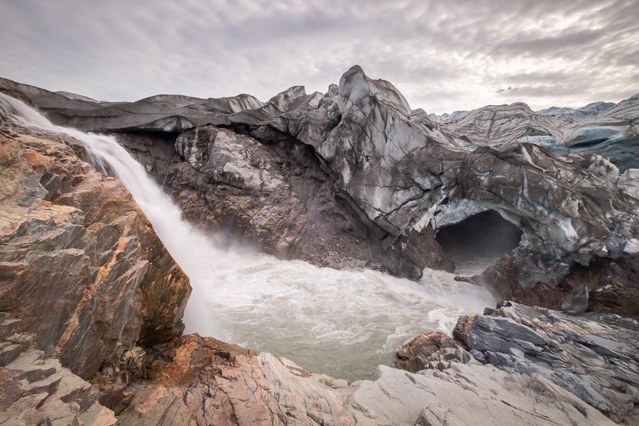
And although you should never approach too closely (you never know when the glacier may calve and send ice falling to either crush you or cause a wave that will sweep you off your feet), there are places where you can literally reach out and touch it.
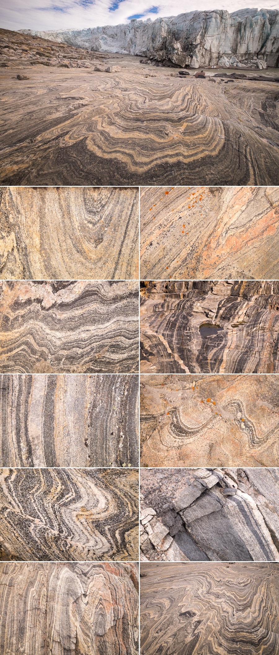
One such place was right near this waterfall spilling into an ice cave under the glacier. Just a little further around, the glacier was still directly grinding on the surrounding rocks, buffing them with the smooth sheen that is so typical of Greenlandic geology.
Speaking of which. I’m thinking of creating a coffee-table book of the patterns of Greenlandic rocks. What do you think of the idea?
I ended up spending the entire day out at the Russell Glacier, even though the tour was only meant to be ~3 hours long. When I returned to the jeep at the allocated time and complained that 1.5hrs wasn’t nearly enough time to explore the area, Tommy said that he had to return later in the day to drop off supplies to some locals and that he could pick me up then if I wanted. Absolutely!
It was an incredible day spent enjoying the peace and solitude of this remarkable site
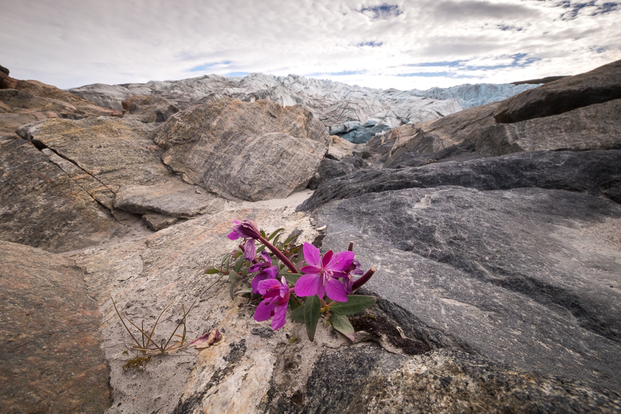
and it struck me that this is what the Perito Moreno Glacier in Argentina must have been like at some point. While Russell Glacier is nowhere near as big as Perito Moreno, it is still a spectacular glacier – made all the more so by the lack of infrastructure and the thousands of tourists.

[Click and drag to see full panorama]
In fact, I pretty much had the place to myself! I only saw 3 other people during the entire day – it seems everybody heads out to Point 660 instead!
Tommy returned to collect me at the end of the day and we stopped off briefly to explore an old plane that crashed back in the 1960s.

And although we kept a keen eye out for wildlife, the best we saw were a few Musk Oxen down in the river valley, a very long way from where we were driving. Oh well, perhaps I’ll get luckier as I hike the Arctic Circle Trail.
Recommendation
A visit to Russell Glacier is a highlight of any stay in Kangerlussuaq. Unfortunately I can’t compare it to Point 660, but I loved the solitude of the glacier and the fact I was pretty much the only one there on this occasion. This certainly wouldn’t have been the case at Point 660 judging by the number of buses I saw heading out there.
The trip with Kang Mini Tours is comfortable and informative and Tommy was happy to stop for photos as often as we wanted. For most people, 1.5 hours at the glacier would probably be enough, though keep in mind that around half that time is spent walking to the main viewpoint and back. The hike is not difficult, but it does take some time.
Discover more about Greenland
I have a large number of blog posts about Greenland, so feel free to read more about my experiences and adventures here on my blog.
Or, if this post has piqued your curiosity about Greenland in general, learn more about this amazing country by:
- checking out more hiking routes near Kangerlussuaq at Destination Arctic Circle
- reading my Greenland-specific blog at Guide to Greenland
- checking out the information and wide range of trips available at Guide to Greenland
- exploring the Government tourism site at Visit Greenland