Trekking Greenland – Unplugged Wilderness Day 6
Day 6 of the Unplugged Wilderness Trek saw us wake up to better weather than we had on Day 4 and Day 5 thank goodness! It looked like the sun might even come out at some point during our hike!
After packing up camp, we convened on the abandoned airstrip of Bluie East Two for a little more info about the area. The US left the cleanup operation in the hands of Greenland and Denmark claiming that the cost of defending the free world had to be shared. Adding that if they foot the bill for Greenland, that would set a precedent for the many other countries in which they’d established and then abandoned bases during WWII.
Yes, the Greenland flies also finally managed to find us (note the head-nets)!

We farewelled the rusted remains of this environmental disaster (which the Danish and Greenlandic Governments have now committed to cleaning up)

and set out along the Ikateq Strait towards the Tunu Fjord. This was a very easy hike compared to the past few days and I spent the majority of it chatting with Filip.
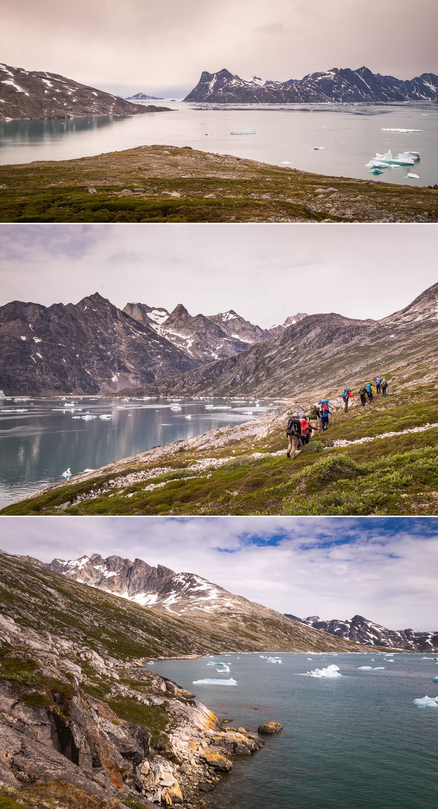
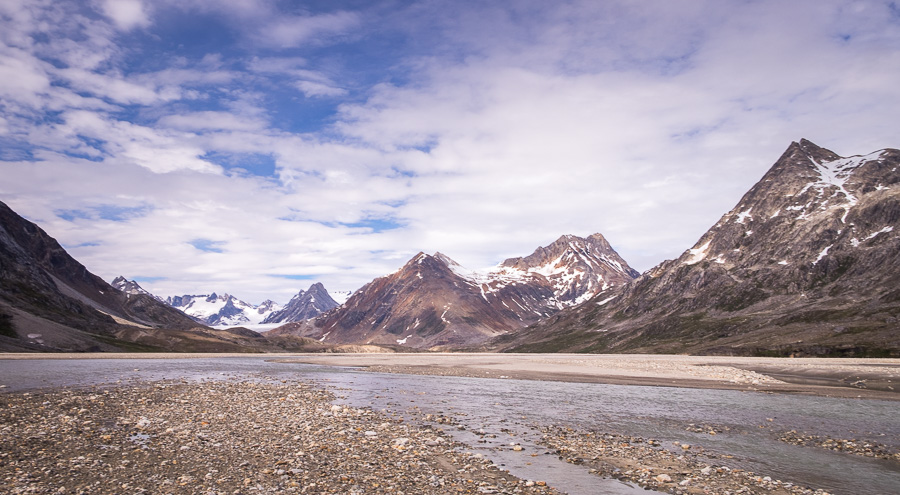
The “highlight” of the day, and the thing we’d all been looking forward to with great anticipation (some might say that “dread” was a more accurate word), was the crossing of a major glacial river just before we reached our next camp in the Tunup Kua valley. Given the recent rain, it wasn’t clear exactly what we’d find when we got there, or for exactly how long we would have to wade (hopefully not swim!) through the water to reach the other side.
Maxime did an amazing job of keeping us out of the water for as long as possible and scouting the best places to cross, managing to find locations where the water only came to knee depth on me.
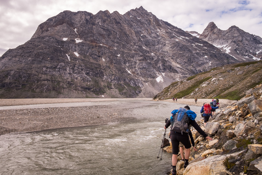
He gave us a bit of a pep talk, and left one of his hiking poles for me to use (it did actually help with the rivers and I was one of only 2 people trekking without them – I tend to find them more of a hindrance than a help in most instances)

and led the way into the river. There was nothing for it but for us to grit our teeth and plunge in after him.

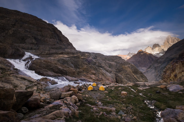
The above image highlights why I could never be a guide in the places I love to trek. While we all waded through as quickly as conceivably possible, Maxime just stood there in the middle of the freezing river in case anyone needed assistance. No way! And although he assures me that you can train yourself to better cope with the cold, I think he may have started with a much greater tolerance for it than I currently have. After all, this is a bloke who’s led the Greenland Icecap Crossing twice!
In the end, there turned out to be 6 river channels that we had to wade through. And I was seriously hurting and wishing for numbness by the time we’d crossed the last one! OK – this was infinitely worse than crossing the river at the start to the Brewster’s Hut track in New Zealand!

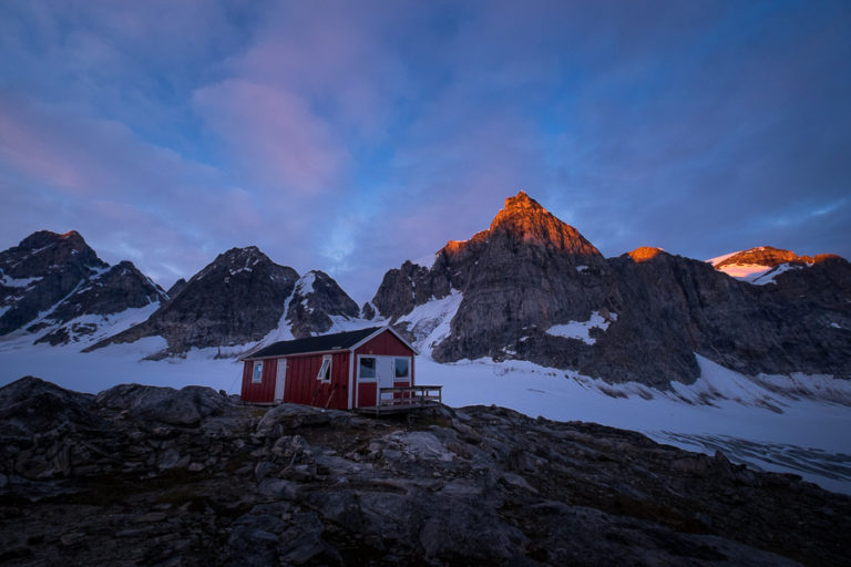
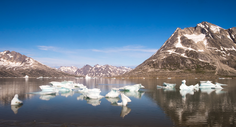
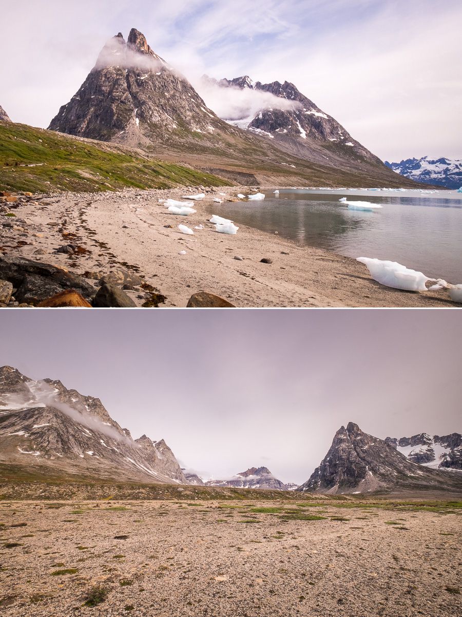
Fortunately the campsite was not too far from the last river crossing, though just far enough that I’d warmed up a little by the time we got there. It also helped that the sun finally came out and we were able to enjoy amazing views

and some warmth, before the sun sank below the mountains behind us and plunged us into the cold shadows again.
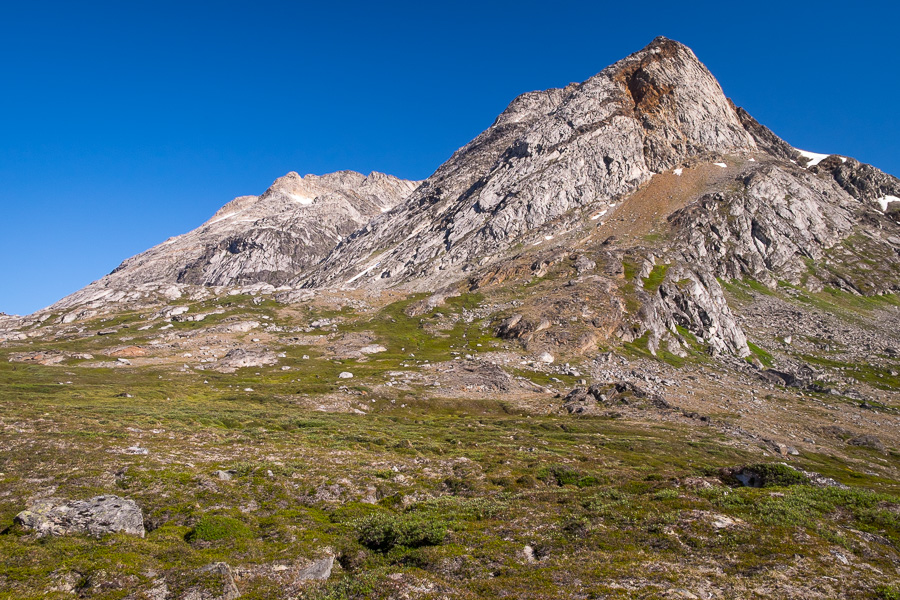
But not before spectacularly lighting up the tops of the mountains 🙂

Trekking Time: approximately 6 hours
Read more about the Unplugged Wilderness Trek
If this post has piqued your curiosity about hiking and trekking in East Greenland, read about the rest of my adventure on the the 12-day Unplugged Wilderness Tour with Greenland Adventures:
- Day 1 – Tasiilaq to Kulusuk and along the Sermiligaaq Fjord
- Day 2 – Hike to the Karale Glacier
- Day 3 – Hike to the lookout over Sermiligaaq Fjord and Karale Fjord
- Day 4 – Karale Fjord camp to Beach camp
- Day 5 – Beach camp to Bluie East Two
- Day 6 – Bluie East Two along the Ikateq strait to the Tunu Fjord
- Day 7 – Tunup Kua Valley to Tasiilaq Fjord
- Day 8 – Along the Tasiilaq Fjord
- Day 9 – Tasiilaq Fjord to Tasiilaq Mountain Hut
- Day 10 – Tasiilaq Mountain Hut
- Day 11 – Tasiilaq Mountain Hut to Tasiilaq Fjord to Kulusuk
- Day 12 – Kulusuk to Reykjavik
- Video Slideshow – of some of my favourite images
If it has sparked an interest in Greenland more generally, learn more about this amazing country at Visit Greenland, and check out the wide range of tours of all kinds (not just hiking and trekking) at Guide to Greenland.