Peru: Huayhuash Circuit – Part 2
Day 6: Viconga (4,407m) – Punta Cuyoc (5,000m) – Huanacpatay (4,300m)
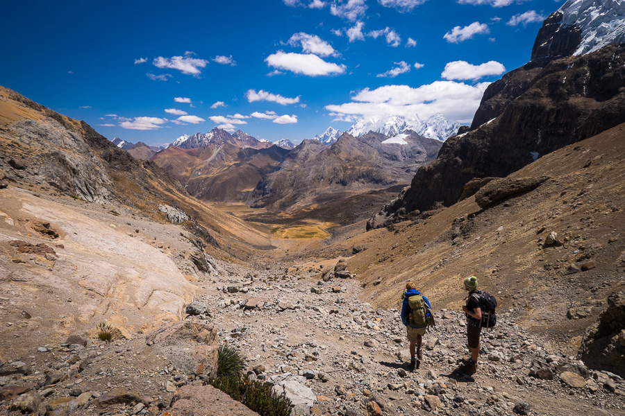
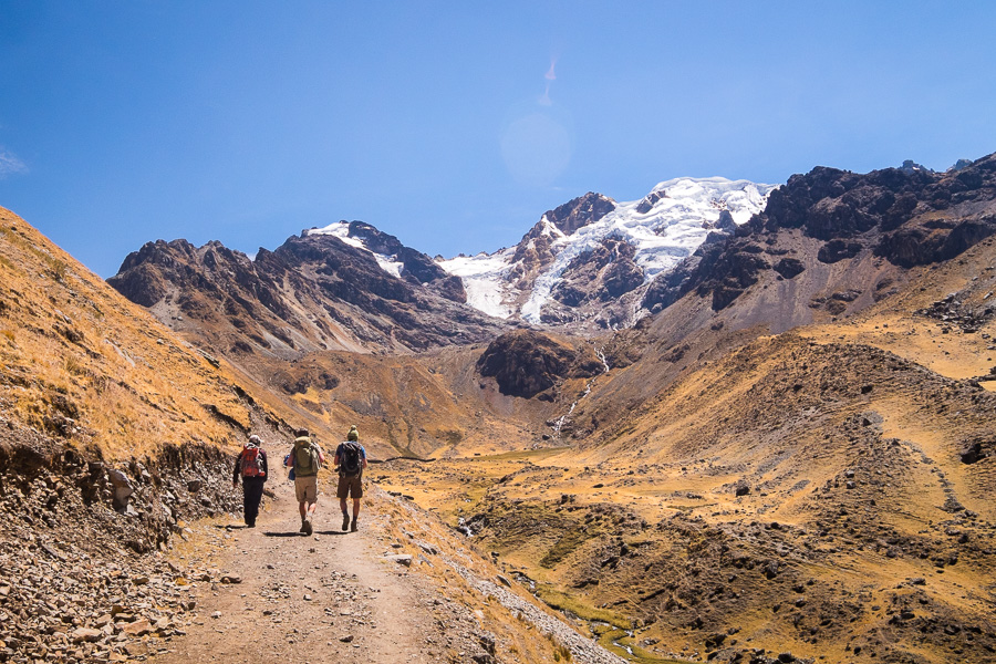
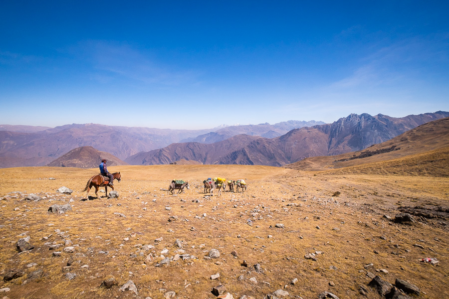
Awoke to yet another gorgeous day, and after our usual awesome breakfast (everything tastes so good when you are camping, and Eliceo is genuinely a master with a 2-burner gas stove!) we started our climb to Punta Cuyoc – one of the highest passes on the trek.
Again though, with the slow altitude pace set by Eliceo – it was really lovely

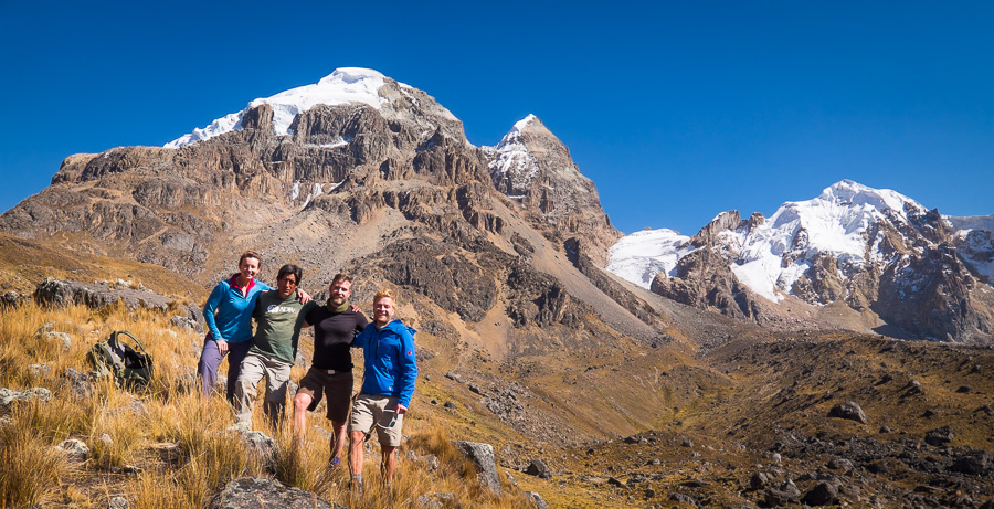
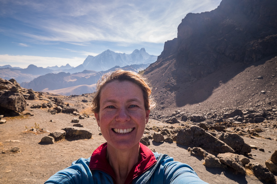
And we finally remembered to take a group photo!
The gorgeous scenery continued as we approached the pass – Max went a bit too close and ended up with a boot full of mud…

Unfortunately, when we finally made the top of the pass, we ran into the rear-guard of the large Israeli group. I will never understand why you would have (really crappy) music blaring when you are in such a pristine environment surrounded by such beauty. But that was how they trekked 🙁 Tried to find a quiet bit of the pass to sit and contemplate … fortunately the wind helped in that regard. Finally, after about 1/2 hour they started their descent and we stayed another 15 minutes or so to just enjoy the silence.

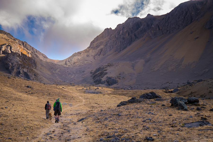
Although climbing up to these passes has given the old heart and lungs a fair bit of a workout, I actually find getting down the other side often more challenging. This was no exception – very steep and slippery rocky paths where you are half the time skating down it trying to keep upright. The first part of this was so steep that one of the dogs that was accompanying the Israeli group (this is where our inherited dog came from as well – apparently he liked us better – perhaps because we walked faster and didn’t have crappy music going all the time) wouldn’t actually start the descent! He was still at the top when we went to depart, whimpering because he was being left behind. In the end, Eliceo enacted a rescue and carried him down the first part of the slope – almost bringing himself unstuck in the process!
We made it to Quebrada Huanacpatay campsite with no real dramas though. How could you not get used to these views!

Day 7: Quebrada Huanacpatay (4,300m) – Santa Rosa Pass (5200m) – Huayllapa (3,500m)
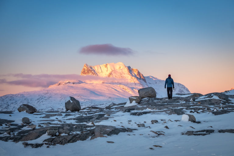
This was the day I was most fearful of. Our highest pass at 5,200m and we were taking a different route to normal. Almost everyone goes over the San Antonio pass (5,020m), but Eliceo’s opinion was that the adjacent Santa Rosa Pass had a more spectacular view of the mountain range, and at the bottom of the descent you could visit one of the lakes as well.
While we were camped the night before, looking across the Huanacpatay valley, I was seriously wondering where the heck the path was and how we were going to climb what looked to be almost vertical!
Turns out – via a lot of switchbacks!
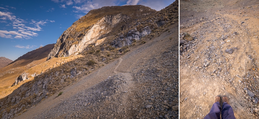
These are only about a foot-width wide and zig-zag up what is essentially a scree slope. You don’t want to suffer from vertigo here!
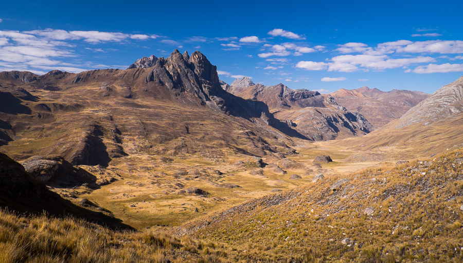
After the initial, very steep first ascent, we encountered a nice flat valley which was a wonderful surprise. It was only a temporary respite, however, we still had a ways to climb to reach the pass.
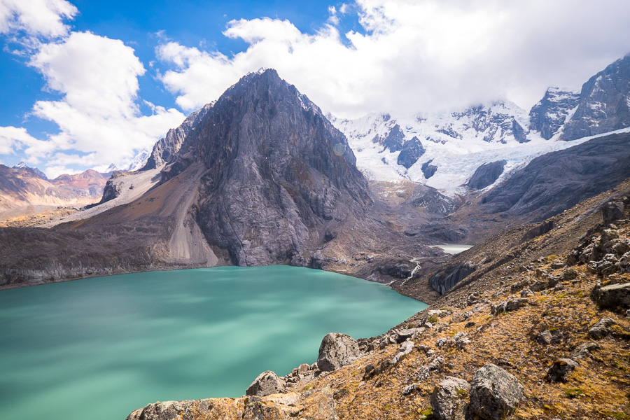
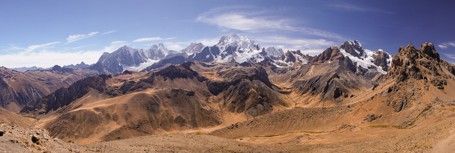
But oh how it was worth it! One of the most spectacular views on the hike, and there have been so many of them!
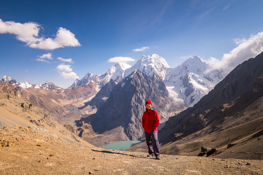
We were actually really lucky and arrived in time to get the complete view without clouds – you can actually see the clouds starting to roll in on the right hand side of the above image. About half hour later, the tops of the mountains were obscured. It was very much worth getting up at the crack of dawn to see this!

We stayed up there for quite a long time, but eventually the cold and wind drove us down the other side. The way down was ridiculously steep – I would hate to think what coming down the even steeper San Antonio pass must be like!

We took our time with plenty of rest stops along the way, and to give the shaky legs a bit of a break from the steep descent

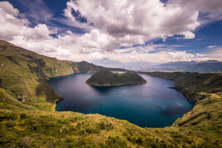
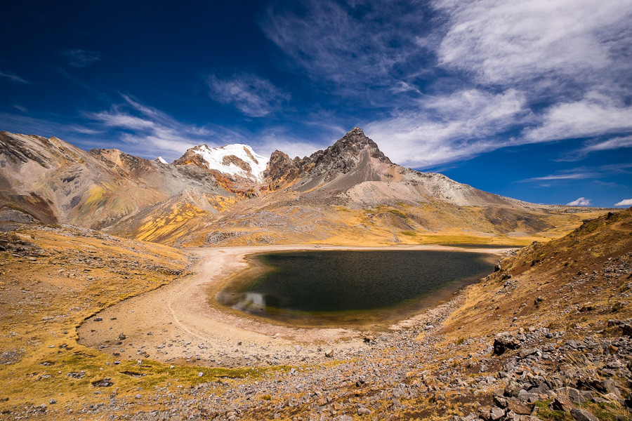
And finally reached the turquoise Laguna Juraucocha. It would have been brilliant to have an extra day camped in this area to explore the lakes (that would have been one of the extensions I would have made), but we had to push on to get to the small village of Huayllapa.
This involved trudging down a long valley, following a river with some pretty cool waterfalls along the way.
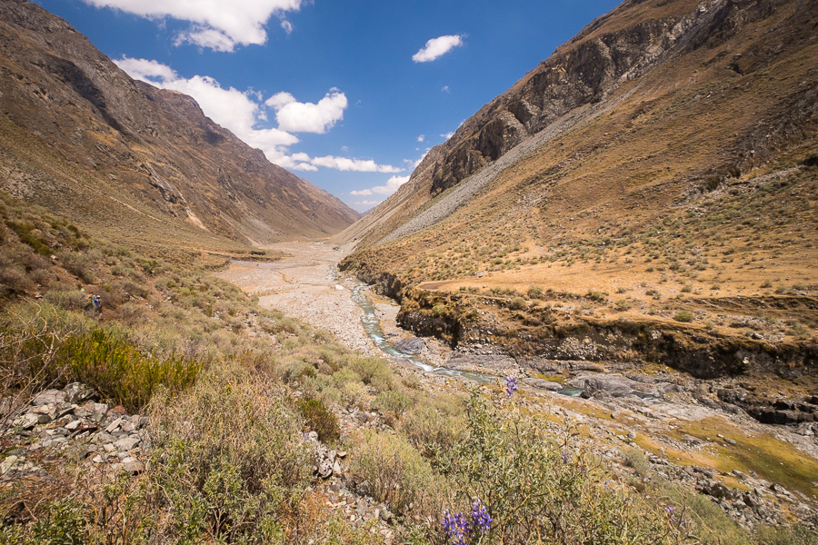
It was pretty, but the least interesting part of the walk. Also hurt to know that we were descending to 3,500m … and we would need to regain all that altitude again tomorrow!
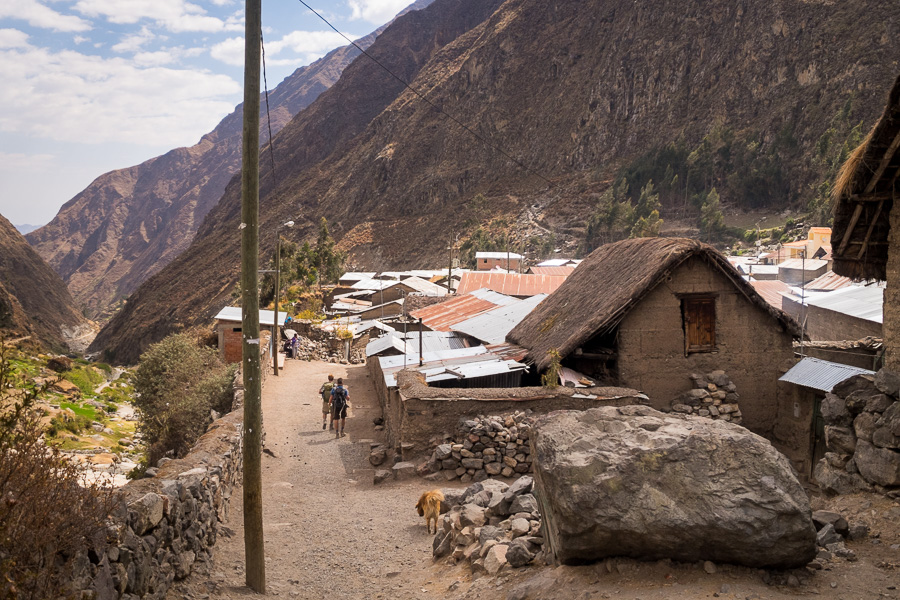
Rather than camp on the soccer field at Huayllapa, we all decided to take some very basic rooms in one of the two hostels in town. Even paid a few Soles more for the opportunity of a hot-ish shower 🙂 Was luxury to sleep in a bed and was not as cold as we have been throughout the rest of the trek
Day 8: Huayllapa (3,500m) – Punta Tapush (4750 m) – Laguna Susucocha (4,654m) – Cashpapampa (4,400m)
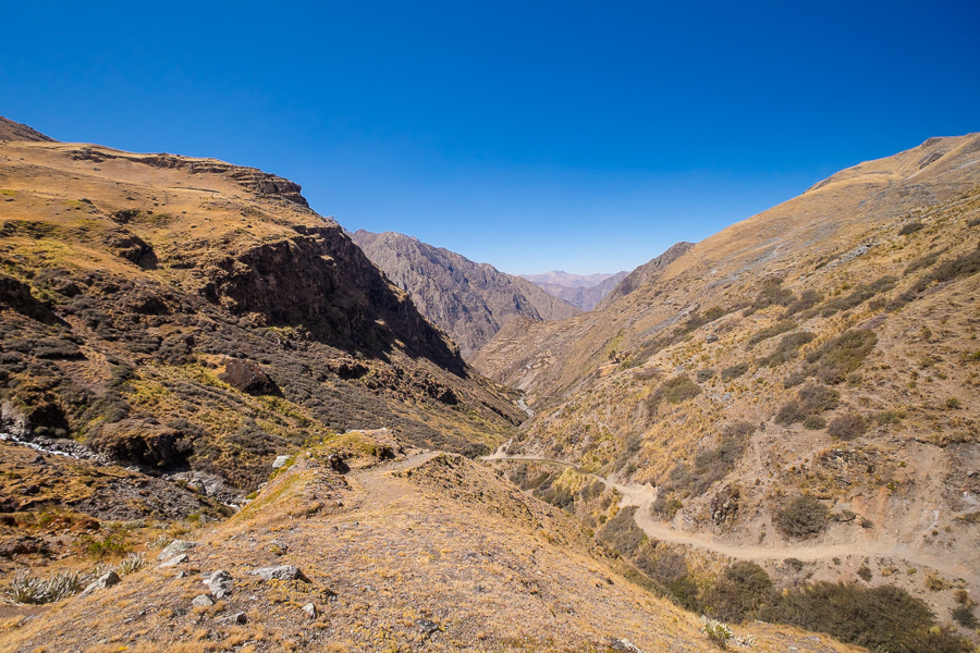
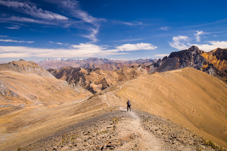
Ok – so regaining all that altitude was not my favourite part of the trek. It wasn’t technically challenging (always a good distraction), and it wasn’t particularly beautiful for the first part either (always a good excuse to stop for photos) – rather it was a long, 4 hour slog up a hill.
Fortunately, after about 3 hours, it did get more beautiful
And the last part up to Punta Tapush was really cool in my opinion. Very rocky, almost seemed volcanic to me.

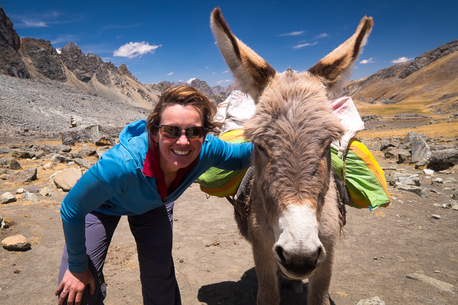
Finally made it

and made a special friend too 🙂
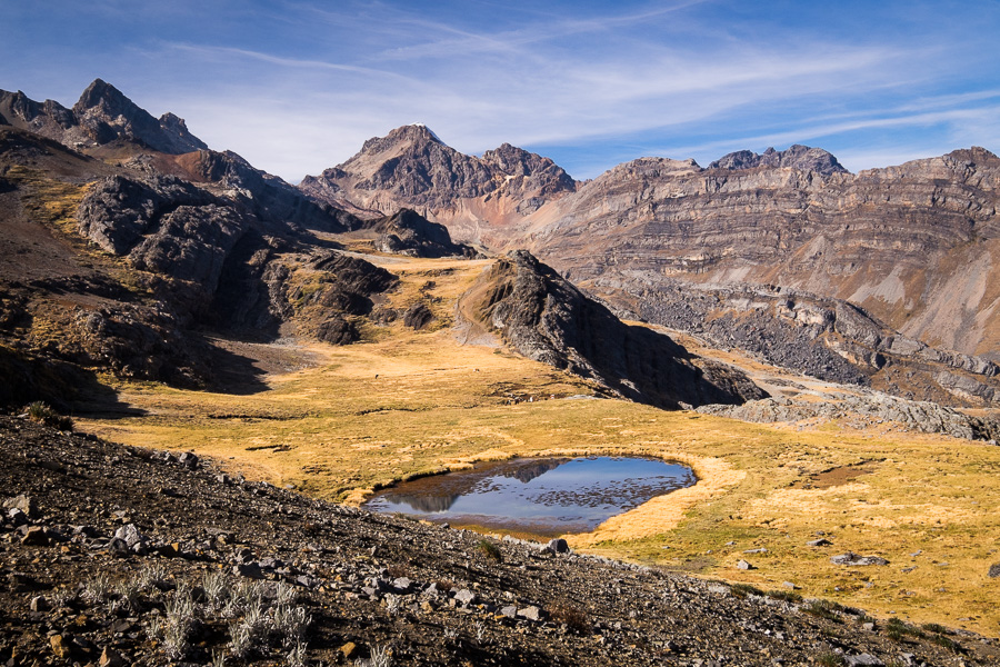
Spent quite a bit of time hanging out up there given it was warm and not too windy, and then headed down to Laguna Susucocha.
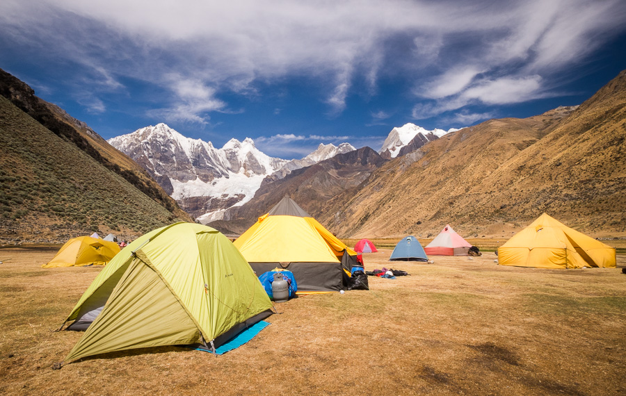
And our slightly swampy campsite at Cashpapampa

Day 9: Cashpapampa (4,400m) – Paso Yaucha (4,800m) – Laguna Jahuacocha (4,150m)
I happily stayed warm in my sleeping bag listening to the guys get ready at 2am for their ascent of Diablo Mudo (the Deaf Devil). Eliceo went with them of course, which meant that I started the day trekking by myself. Elijio pointed me in the right direction, said that I really shouldn’t get lost and off I set.

It was quite a different experience hiking by myself rather than following Max and Nico and Eliceo from a distance. On the couple of occasions where I thought the path was not entirely obvious – I had to go looking for myself to find the way. And, on top of the pass, I had to try to take my “pass photo” as a selfie … this is quite difficult to do with an actual camera (rather than a phone)
The nice thing about it, however, was that I was able to spend as long as I wanted at the top! And the view did not disappoint, even though the light at that time of day wasn’t the best for photos.
It was also an inspired idea to sit and contemplate for a while, as it meant that a couple of Israelis (yes there are lots in Huayhuash) and their guide caught up to me. Their guide was a good friend of Eliceo and so I joined them as they went for a slight detour out to another viewpoint.
Eliceo later told me that he specifically didn’t tell me about this viewpoint because it can be quite dangerous to get down from there. But can you imagine being so close and not getting to see this?!

I take Eliceo’s point though – the descent from here was incredibly steep and I fell (softly) several times before finally arriving at Laguna Jahuacocha and our last campsite for the trek.
It was quite a popular place actually – saw more people here than at any other time on the trek. Fresh fried trout (caught especially by Elijio) for dinner was the perfect final meal, and the others washed it down with a bottle of red wine which had somehow survived the entire trip!
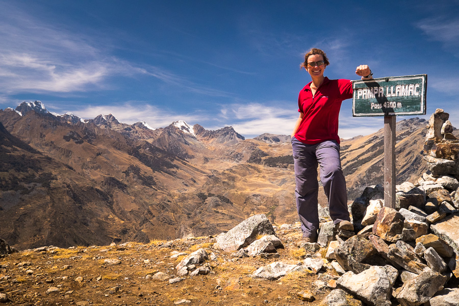
Day 10: Laguna Jahuacocha (4,150m) – Paso Llamac (4,300m) – Lamac (3,200m) – Huaraz (3,053m)
The area around Laguna Jahuacocha would be another place to spend an extra day exploring if you had it. But unfortunately we had to meet our transport, so it was up, up, up, up another interminable climb.

It all looked so similar that you would swear that the corner you were facing was identical to the one you rounded about 10 minutes ago, and because the gorgeous mountains of yesterday were directly behind us, we didn’t have any awe-inspiring views to distract us.
But, one foot in front of the other at Eliceo’s snail’s pace, and we made it to Pampa Llamac eventually.


Elijio caught up to us at the top, made some adjustments to the donkey’s loads, and led the way for our final descent.

We passed the ruin of the house (almost nothing there now) of where Eliceo grew up, and finally reached our destination – the village of Llamac – where our transportation was awaiting us and we had to say goodbye to Elijio and his donkeys.

Then it was the long road back to Huaraz – dropping Max and Nico off at the highway as they were heading directly back to Lima.
Really amazing feeling to have finished the hike – the sense of accomplishment really is something spectacular. And I’m just infinitely grateful that I had the opportunity to do it, and share the experience with such amazing people!
Right… time to wash some clothes that are almost walking for themselves :-/
Read about the first part of this incredible trek in Huayhuash Circuit Trek – Part 1!
Recommendations
For those of you who have been inspired by the above (and it’s very hard not to be!), a few things to note. This trek is probably not for you if:
- you don’t like camping
- you haven’t done an extended trek before (I did the 8-day Torres del Paine Circuit Trek in Chilean Patagonia last year, which was also awesome. Actually, it is what inspired me to do more multi-day treks like this)
- you suffer badly from the cold (OK – so this describes me, but I survived 🙂 ) Make sure you bring a -20 degree sleeping bag – you are going to need it!
- you aren’t in decent shape – it’s 10 days of trekking at altitude – enough said
- you don’t do altitude well – you are above 4000m 98% of the time so make sure you can handle the altitude before committing
- you suffer from vertigo – there are many, many places where there are very, very steep drop-offs as you skirt around the edges of mountains on scree-slopes
- you have bad knees – there are 3 days that involve very, very steep descents of more than an hour – they are knee killers!
- you don’t have good balance – read last 2 dot points!
Best months for the trek are May – September and most companies only offer hikes during this time. I organised through Peru Qorianka which must have some sort of affiliation with Active Peru, and was very, very happy with the trip and the quality of the equipment provided.
Cost: I paid USD$720 + a tip for Eliceo and Elijio. This included transport to and from Huayhuash, guide, donkey driver + donkeys, 5 meals/day and all equipment. Couldn’t ask for more.
Time: I really liked the relaxed nature of the 10-day trek where we had time to really appreciate the journey and also have some downtime from walking. Some do it in 8 days, which would be much tougher – especially as there would be at least one day with multiple passes to climb. 12 days would be ideal – so you could add in a few day hikes around Laguna Juraucocha and Laguna Jahuacocha.