Hiking Greenland – Igaliku Lake and Plateau
When I arrived at the Gardar Hostel in Igaliku, one of the first things I did was consult the map of hikes in the area. All of the hostels run by Blue Ice Explorer have the appropriate map displayed prominently in the common area, with brief descriptions of the routes alongside. Seriously, the hostels in South Greenland are amazing!
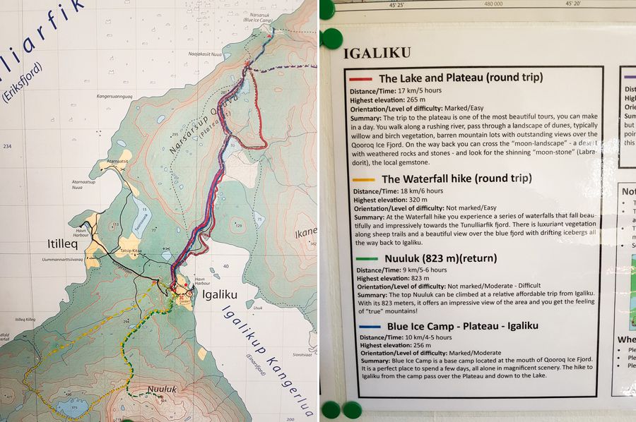
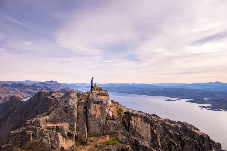
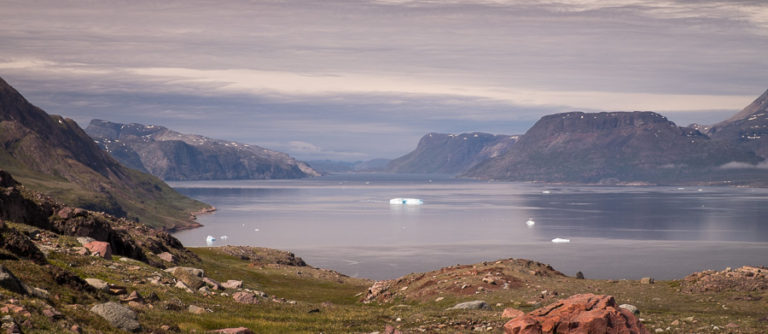
The Lake and Plateau Hike (marked in red in the above map) is the hike everyone does when they come to Igaliku, as it ends up at an amazing viewpoint overlooking the Tunulliarfik Fjord and the Qooroq Glacier.
Much like yesterday, today started off foggy, but I could see patches of blue sky appearing around 9:30am so, after a quick trip to the Pilersuisoq (grocery store chain) at 10am, I started hiking.

The more extensive trail notes (obtained at the Igaliku Country Hotel for a deposit) said to follow the sheep trails along the shore of the fjord rather than the road, but that seemed to want me to walk straight through the middle of a new Solar Plant the 2 Danish guys who were also staying in the hostel were building, so I ended up sticking with the road.
I don’t like walking on pebbly roads 🙁 Gravel is fine. But not pebbles!

Fortunately, this ended at a lake

and then the “red dots”, which (in theory) mark all the hiking routes in this area,

took me up to the plateau along sheep trails. Much better hiking!

More gorgeous lakes
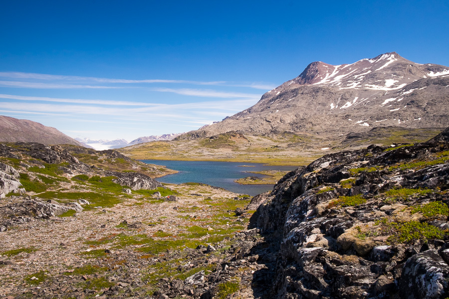
led to the viewpoint. And it was a stunning view!
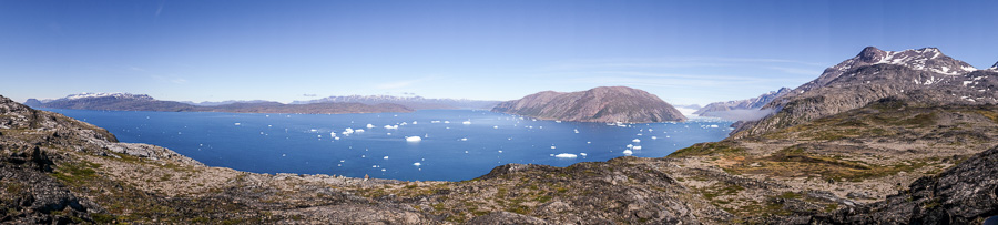
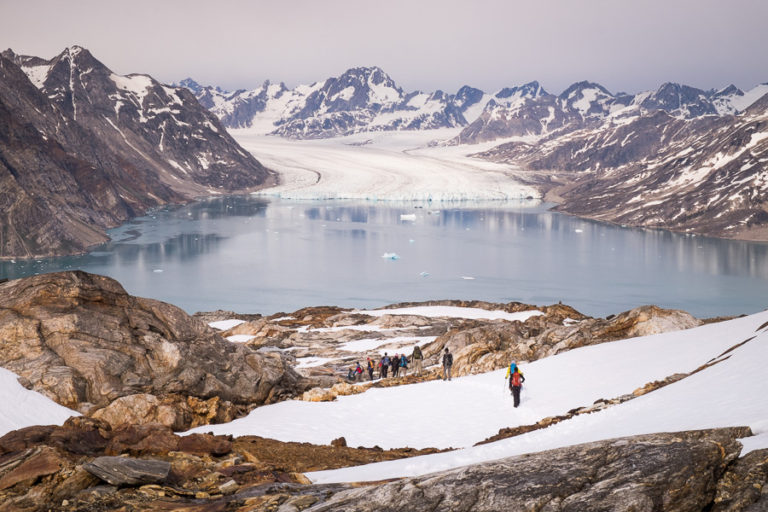
Although still quite a distance away, the view of the Qooroq Glacier and its cast off icebergs was amazing.

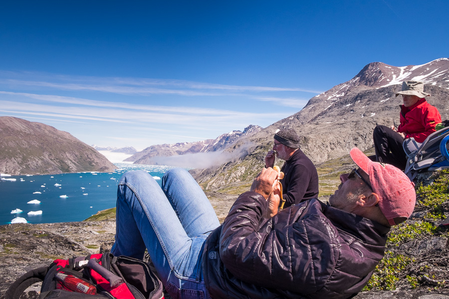
Oh, and I ran into these jokers up there too! David (with the banana) was staying in the Gardar Hostel with me, and I’d met the German couple in Narsaq 🙂
The return route was via a “moon-landscape – a desert with weathered rocks and stones” (according to the trip description), where I could search for “moonstone” to add to my collection of not-Tugtupit. Unfortunately, moonstone doesn’t actually look that different to regular old granite (the Igaliku Country Hotel had some samples on their counter), so who knows if I saw any or not. I decided not to add to the weight of my bag in the off chance I actually got it right.

We all ended up doing a bit of a choose-your-own-adventure to find our way back to the initial trail (in theory it was marked across the moonscape, but in practice…) And then we found the dots that led us off the road and along the fjord for our return journey to Igaliku (much nicer than hiking along the road!). It turns out we did have to walk through the middle of the Solar plant after all!

Oh – and you really don’t get a good understanding of just how many Trans-Atlantic flights there are every day until you do the Lake and Plateau Hike from Igaliku!
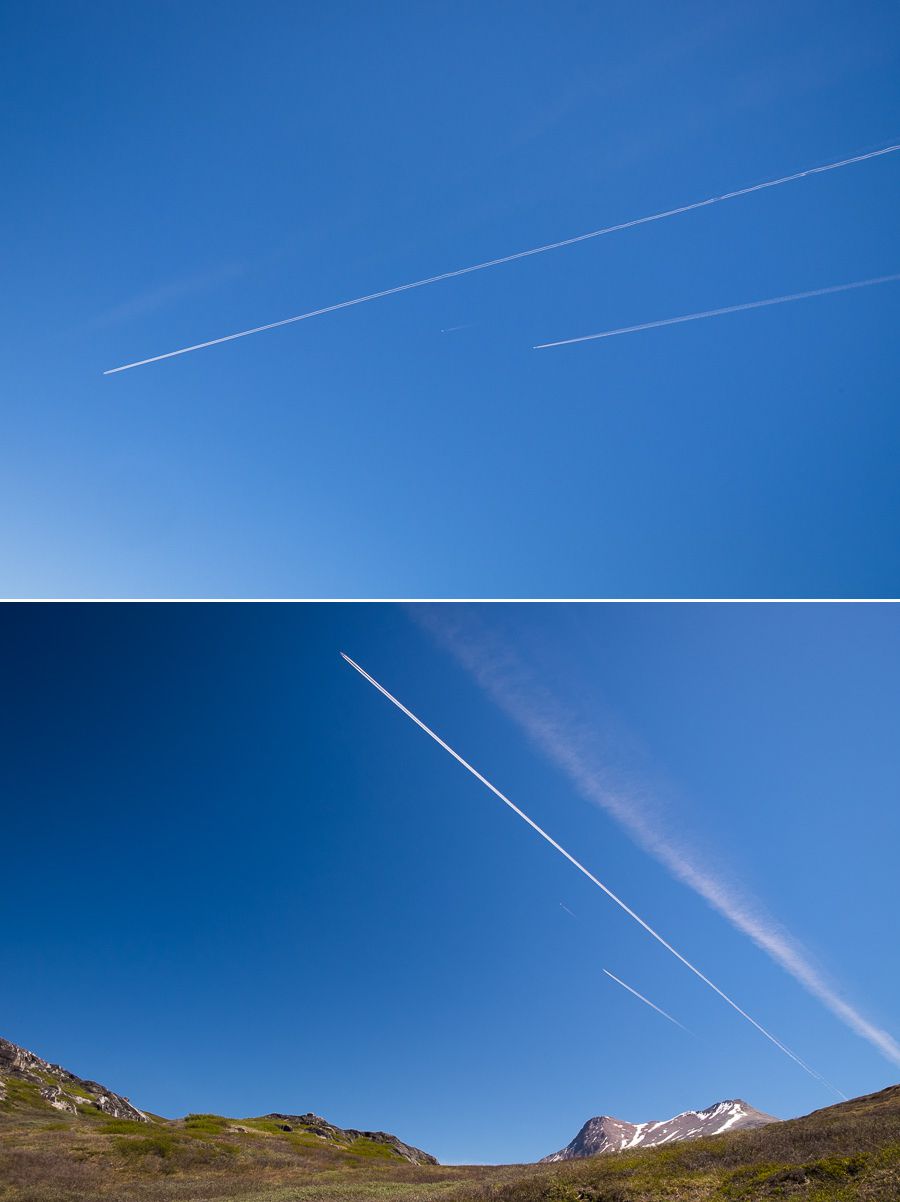
Seriously – there would have had to have been at least 5 contrails at any one time overhead. It was like Pitt Street up there!
Distance: ~17km
Time: ~6 hours (we took 7 because we spent so long admiring the view at the lookout point 😊)
Discover more about Greenland
If this post has piqued your curiosity about Greenland, learn more about this amazing country at Visit Greenland, and check out the wide range of tours of all kinds (not just hiking and trekking) at Guide to Greenland.