Hiking Greenland – Sisimiut’s UFO Hut
My plan upon arriving in Sisimiut after trekking the 160km Arctic Circle Trail from Kangerlussuaq, was to spend several more days in town doing day-hikes around the area. I found .gpx trails for several hikes at Destination Arctic Circle (thanks guys!) and was super-keen to do the “UFO Hike” in particular. After all, what exactly would I find at the end of a “UFO Hike”??
As with the hike to the summit of Nasaasaaq mountain, the first 3.5km of this trail follows a dirt road out of town. Fortunately it is a different dirt road to the one that leads to Nasaasaaq and the Arctic Circle Trail (which I’d already seen 3 times by now), and there is a period of interest when it leads you right through the middle of “Dog Town”. This is the area on the outskirts of Sisimiut where the majority of town’s Greenlandic Sled Dogs are chained awaiting the winter months. I grumbled to Tyson about hiking along roads (it’s definitely not my favourite thing) as we made our way to its end and the start of the trail.

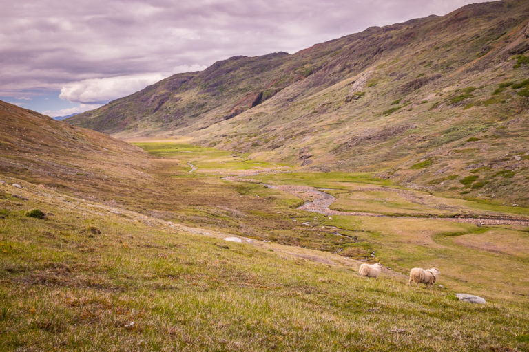
The narrow track we followed through the wilderness led us slowly upward, and my complaining stopped completely when we crested the first ridge and had a clear view of the valley we’d be hiking through. The landscape in front of us was absolutely stunning!

[move cursor over image to see the full panorama]
We stayed on the high track (we could see another below us) for several kilometers before it seemed to just disappear. The track below us was also no longer visible. Checking the trail notes we had picked up in the foyer of the Hotel Sisimiut, we had clearly come to the part described by the following:
…it may be difficult to find the trail at this point, but when in doubt follow the running water that flows between the mountains at the bottom of the valley…
Hotel Sisimiut
Hmmmm…
“Oh well” we figured as we headed down towards the boggy ground around the river – something we’d been trying to avoid by staying high 🙁
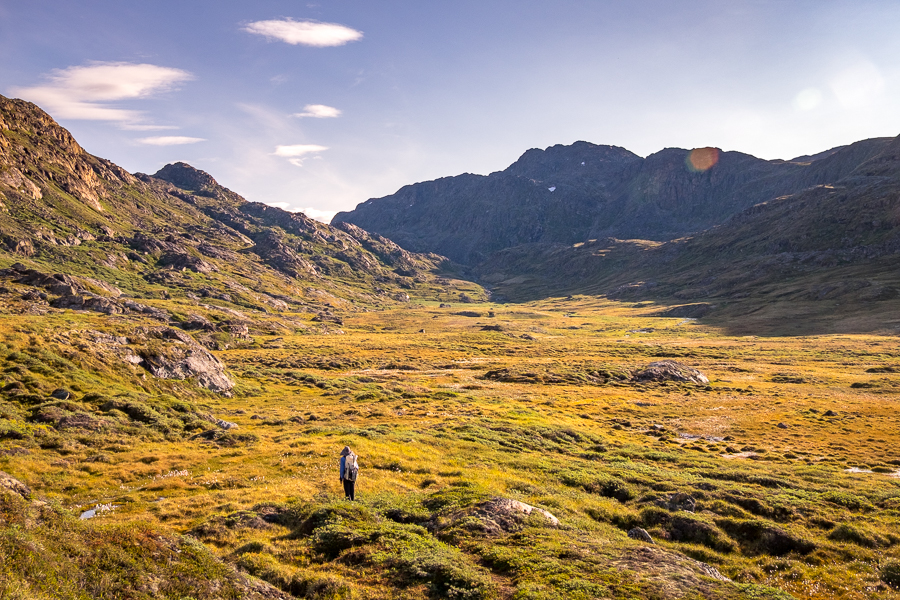
Our hope was to find a physical trail at the bottom of the valley that would coincide with the .gpx trail I had downloaded (the ridge trail was off by about 500m). But alas, there was no trail to be found.
Right.
Time to start bush-bashing!

This is not the easiest thing to do when your boots have sunk so far into the spongy moss that they have all but disappeared (I actually ended up face-first a couple of times after stepping in hidden holes). Nor is it easy when, having made it through the moss, you are then confronted with a hip-high wall of Arctic Willow!

2km later and wringing wet (the dew-laden Arctic Willow saturated me within 5 steps) it was a relief to finally recover the trail and exit this “uncharted” section of the hike.

The trail became more obvious (and much dryer!) as we started to climb. Then – a sudden surprise! A beautiful lake with almost perfect reflections!
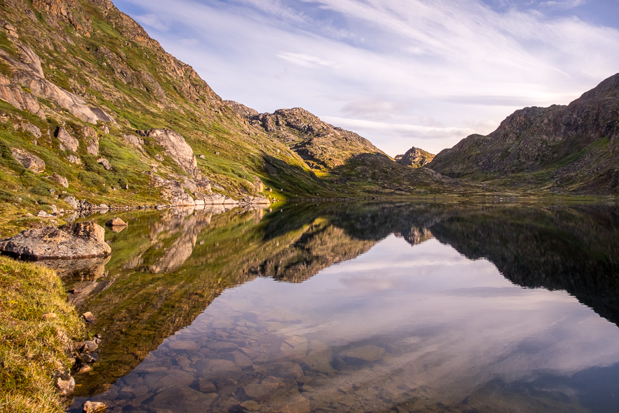
Given that this relatively large body of water didn’t appear on Maps.Me (the offline map app of choice for both Tyson and myself), we decided to name it “Hidden Lake” as we hiked around its edge.
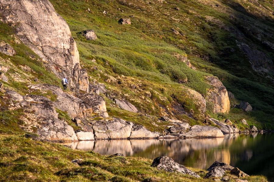
A second lake appeared after the first, and both the views in the direction we were heading and back down over the lakes became more and more stunning as we crested several false passes.
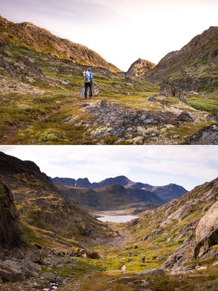
Eventually, we arrived at the actual pass and could see our final destination – still about 3km distant.

Crossing this final stretch towards Sisimiut’s UFO was a bit of a surreal experience. How cool is it to have a back-country hut in the shape of a UFO?!

We climbed the ladder into the heart of the ship to check out the inside. There was no lock, just a circular disk of plywood covering the access hatch, and nothing inside either.

It was a great place to escape the cool breeze that had sprung up and have lunch, but I imagine it would be extremely noisy, and the structure would move quite a bit if you had more than about 4 people in there! It is an actual Hut that you can stay at, and our friend Aqqalooraq, who works reception at the Hotel Sisimiut, told us he’d been there several years ago on a school excursion.

[move cursor over image to see the full panorama]
One thing about Sisimiut’s aliens – they picked an amazingly beautiful spot to land!
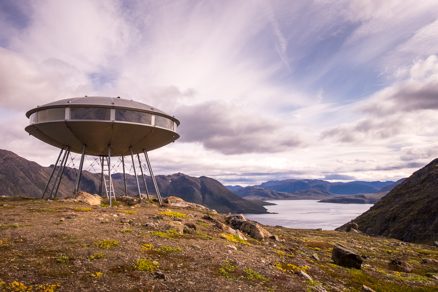
Well … actually, they didn’t initially.
The UFO was originally located just outside of Sisimiut and was transported to its current location overlooking the Kangerluarsuk Fjord (at the opposite end to the Kangerluarsuk Tulleq Nord hut) by helicopter in the 1980s. Why it was built in the first place … I don’t have the full story yet, but will update this post once I do 🙂
The hike back to Sisimiut was along the same route as we took to get out to the UFO. It really is a very, very beautiful hike, and I entertained myself with a game of “could this be evidence of alien life?” as we made the return trip.

When we got back to the “uncharted” part of the hike, we did another search for a trail (the last thing we wanted to do was bush-bash through again), but there was nothing visible from this direction either. We suspect the trail has simply been overgrown. Let me know if you find it!
Just before we reached the end of the trail where it rejoins the road, we started to come across lots of locals picking crowberries. It was a Sunday afternoon and whole families were out with buckets collecting these slightly tart berries to turn into desserts for the week.
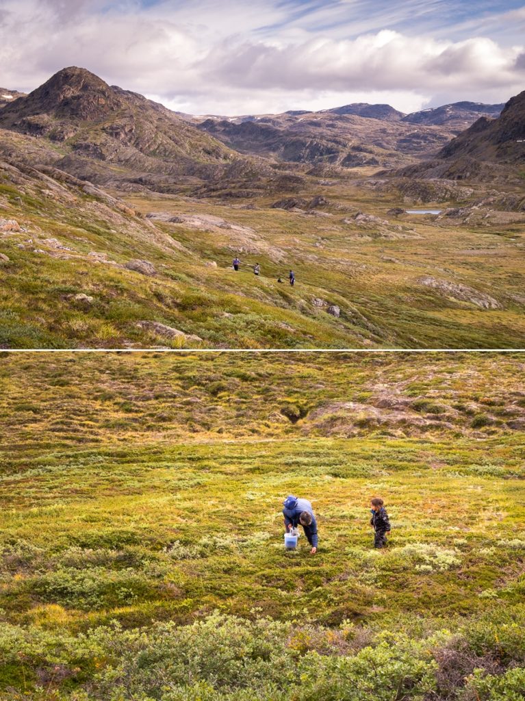
I was only introduced to the joys of wild foraging earlier this year, and certainly picked my fill of blueberries as I hiked along the Arctic Circle Trail. I love that gathering crowberries, blueberries and mushrooms seems to be a common past-time for the residents of Sisimiut – at least from what I saw during my week and a half there at the end of August 🙂
Recommendation
The hike out to the UFO Hut from Sisimiut is not technically challenging (unless you count the bush-bashing part) but it is long.
The reward is hiking through an incredibly beautiful valley, and the surreal experience of being able to climb into a UFO at the end of it! I loved this hike!
Trekking Information
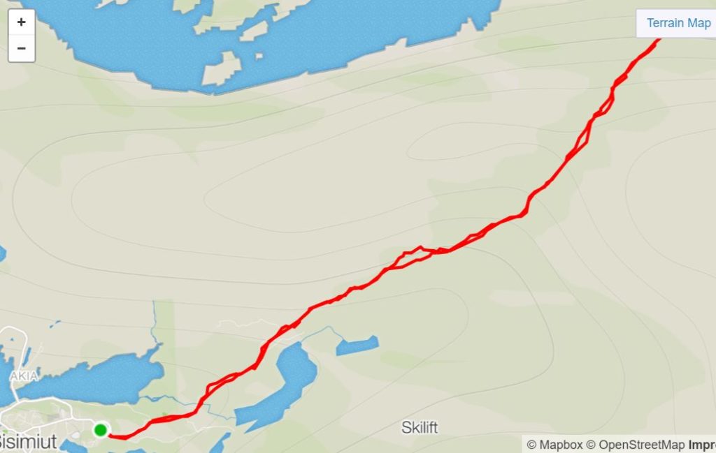
Distance = 23.2km
Time taken = 6hr 39mins
GPX File = Visit hiking.gl for official GPX routes for all trails in Destination Arctic Circle
Strava Link =https://www.strava.com/activities/1813014060
Map
Altitude Profile

Discover more about Greenland
I have a large number of blog posts about Greenland, so feel free to read more about my experiences and hiking adventures here on my blog.
Or, if this post has piqued your curiosity about Greenland in general, learn more about this amazing country by:
- checking out more hiking routes near Sisimiut at Destination Arctic Circle
- reading my Greenland-specific blog at Guide to Greenland
- checking out the information and wide range of trips available at Guide to Greenland
- exploring the Government tourism site at Visit Greenland

