Hiking Greenland – Nasaasaaq Mountain – Sisimiut
The most popular day-hike from Sisimiut is the climb up Palasip Qaqqaa – the 544m mountain that overlooks the airport. However, Tyson and I aren’t really ones to follow the crowds, and so on the first clear day after arriving in Sisimiut, we decided to tackle the pyramid-shaped Nasaasaaq Mountain (784m) instead.

We picked up the trail notes for the “Hard Route” (of course!) from the foyer of the Hotel Sisimiut and headed along the extremely boring 2km of road past the lakes that provide the town with drinking water. We had already hiked this section of road a few days earlier when we arrived in Sisimiut after 8 days on the Arctic Circle Trail. It wasn’t interesting then, and was even less so now! But as soon as we left the road and started trying to follow the trail notes, things became very interesting indeed!
We headed across boggy ground towards the rocky knoll as per the instructions
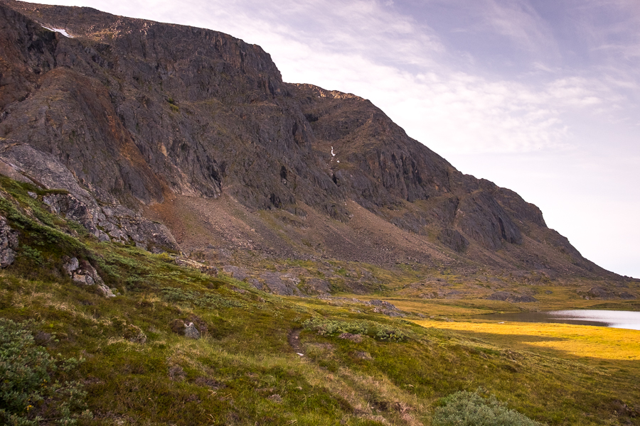
and figured that the steep gully to our left looked about right.

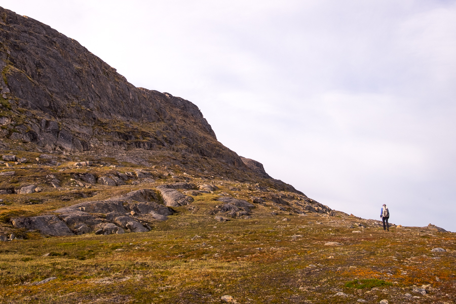
The added bonus was a fairly well defined track that we followed for most of the way up, and the occasional small stone cairn with blue paint on it.

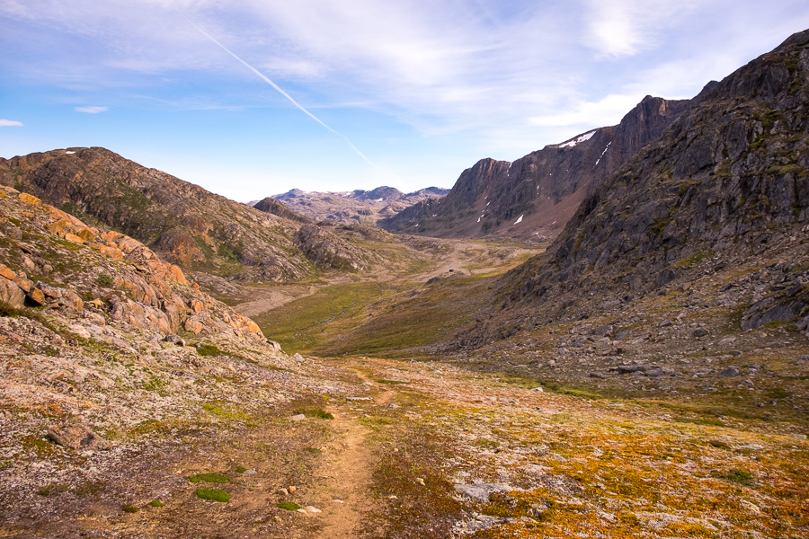
At the top of the pass we had a beautiful view over the valley we’d hiked along on the last day of the Arctic Circle Trail

before turning right along a very faint trail leading off to what looked to be a cairn in the distance. Hmmm… Is this right? It was what the trail notes said to do, but it didn’t inspire confidence that our “superhighway” trail suddenly became barely visible.
We persevered, however, and eventually arrived at the structure I had seen from the pass. It was indeed a cairn, and it even had blue paint on it!

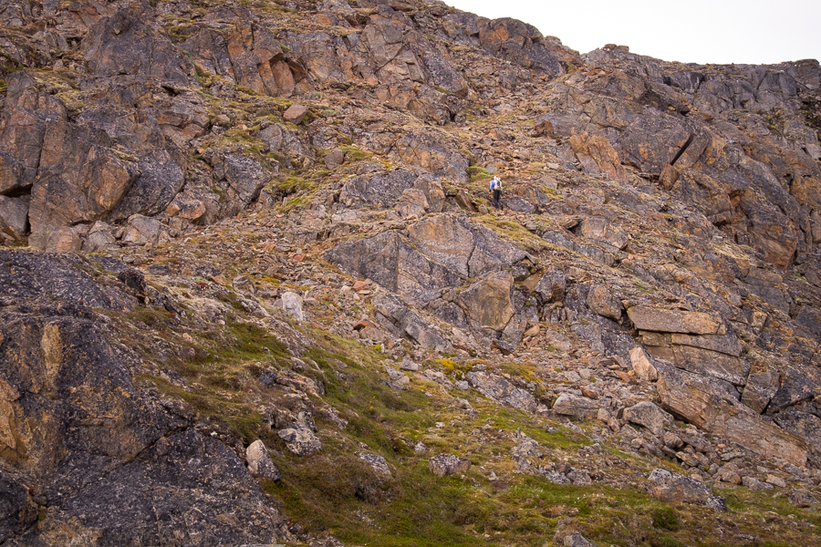
This was a relief, as we were clearly not following the .gpx trail I’d downloaded. That trail was about 100m straight up the cliff towering above us, with no way for us to reach it from our current location. We really had little choice but to follow the edge of the cliff or backtrack and try to find a different route. We decided to press on…

Fortunately, we encountered several other cairns, which ultimately led us along the upper flank of the mountain. Meanwhile, Tyson did his best to ignore the very steep drop-off to our right (fortunately dodgy heights don’t worry me too much)!

Eventually, the trail turned upwards and we played “spot the blue spot” as we ascended through the rocks to the saddle point mentioned in the trail notes. It did exist! Despite us long having given up hope of ever finding it.
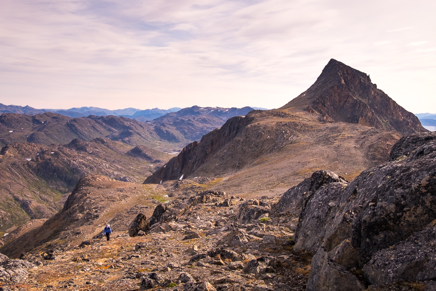
Now that we’d managed to make it onto the ridge, we decided to first of all head over to our right to explore the rocky bluff in that direction.

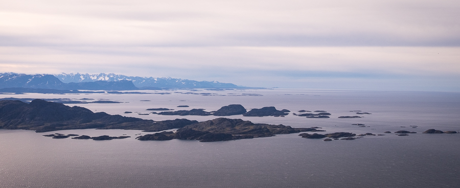
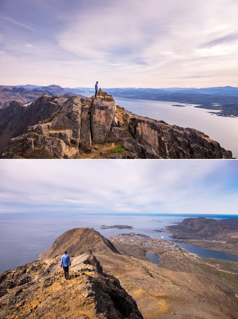
We had a great view back over to our goal for the hike – the summit of Narsaasaaq,
as well as Sisimiut

and the alpine peaks along the Arctic Circle to the South of the city.
After taking in the views for a while, it was time to turn around and head for the main event.

The closer we got to the final ascent, the more daunting it looked.

And indeed. This is not one for the faint-hearted or vertiginous! For the most part, it is a very, very steep rock scramble/climb, though there is a trail to help guide you along the only accessible route

which has ropes to help you up/down otherwise impassable obstacles.
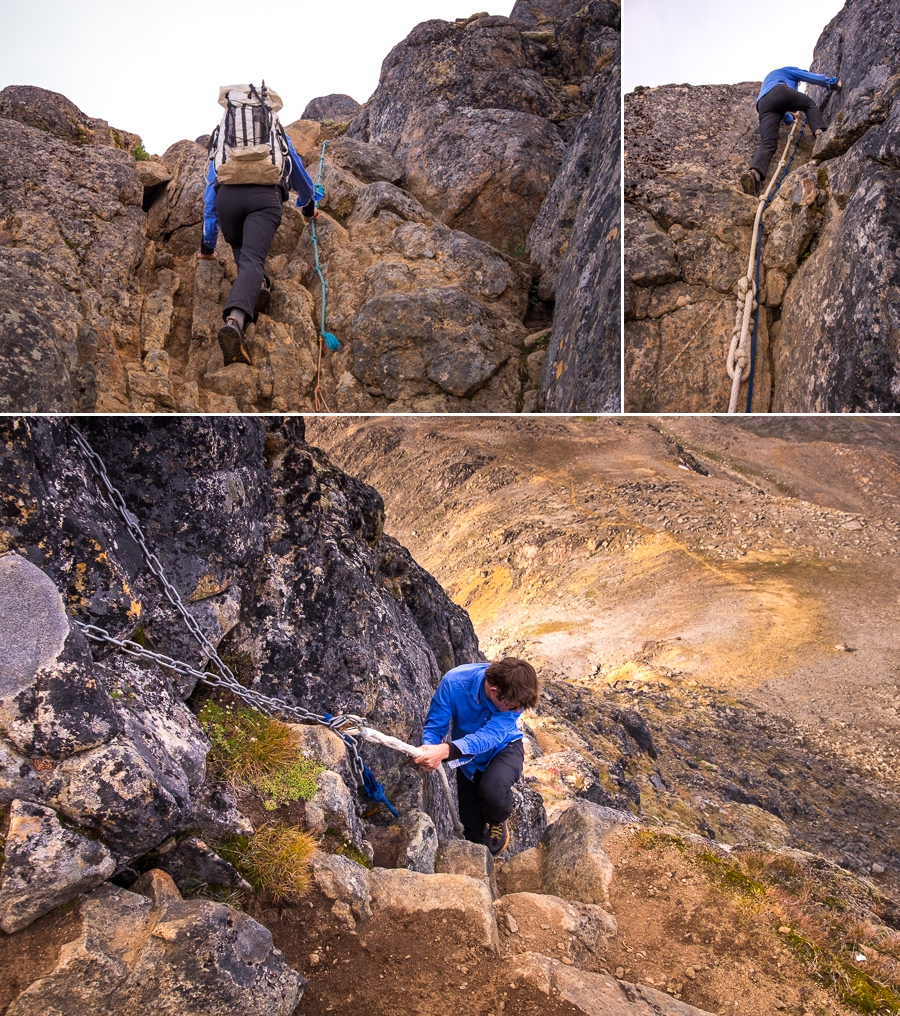
In the end, the 360-degree panoramic reward was totally worth the effort and nerves – especially on a day like this with clear views and no wind.

[move cursor over the image to see the full panorama]

[move cursor over the image to see the full panorama]
Unfortunately, the light was not the best for photography 🙁 If I ever get another opportunity, I will camp at the saddle and climb the peak twice – once in the evening for the views over the Amerloq fjord and the abandoned settlement of Assaqutaq, and again in the morning for views over the valley through which the Arctic Circle Trail runs.

After about an hour at the top, we very carefully made our way back to the saddle and decided to follow the “Medium-hard Route” back to Sisimiut.
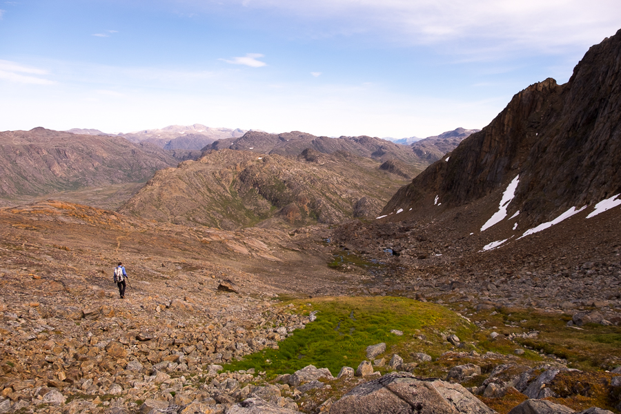
This trail led us down towards the valley with the Arctic Circle Trail, and there we discovered where we’d gone wrong on the way up.
At the top of the first gully, we should have walked about 100m further and started to descend before turning right. There is a VERY obvious trail heading up towards the saddle if you do that, and all of the “Hard Route” trail notes suddenly make perfect sense. I guess we followed the “Super-hard-core Route” up the mountain! But it did have more spectacular views 😉
The “Medium-hard Route” is another obvious track that turns off from the Arctic Circle Trail rather than ascending up the gully. If you are hiking the Arctic Circle Trail, have time, and the weather is reasonable, I’d recommend taking this trail at the end of the hike and spending an extra night camping at the saddle of Nasaasaaq. This would allow you to climb the mountain on the way into town, rather than doing it as a day hike afterwards. Look for the cairn with both red (indicating the Arctic Circle Trail) and blue (indicating the Nasaasaaq trail) paint on it, and a trail leading off to your left as you approach Sisimiut.
Recommendation
The hike to the summit of Nasaasaaq mountain is truly spectacular and a little challenging – even if you don’t take the “Super-hard-core Route”.
Both the “Hard Route” and “Medium-hard Route” have steep sections and parts where you need to scramble over rocks, but the real issue is the final ascent to the summit. If you are not good with heights or are uncertain about your abilities, do not attempt this part!! You still have amazing views over Sisimiut, the mountains along the Arctic Circle to the South, and up the Amerloq Fjord from the rocky bluff at the end of the Nasaasaaq range, so stick with that and don’t force a search and rescue operation (it is more common than you imagine!)
Trekking Information
Distance = 14.7km
Time taken = 6hr 35mins
GPX File = Visit hiking.gl for official GPX routes for all trails in Destination Arctic Circle
Strava Link = https://www.strava.com/activities/1813015128
Map

Altitude Profile

Discover more about Greenland
I have a large number of blog posts about Greenland, so feel free to read more about my experiences and hiking adventures here on my blog.
Or, if this post has piqued your curiosity about Greenland in general, learn more about this amazing country by:
- checking out more hiking routes near Sisimiut at Destination Arctic Circle
- reading my Greenland-specific blog at Guide to Greenland
- checking out the information and wide range of trips available at Guide to Greenland
- exploring the Government tourism site at Visit Greenland