Hiking Greenland – Icefjords and Remote Villages – Sermilik Way
It was another grey morning as we schlepped all our gear out of the hut and back down to the boat from Arctic Dream that was waiting to transfer us from Tiniteqilaaq to the start of the “Sermilik Way”.
While my sensible travel companions enjoyed the comfort inside Lars’ new boat
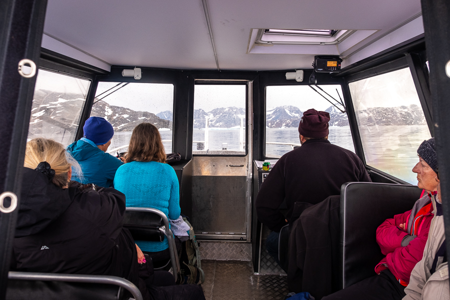
I chose to sit out the back with all of our gear

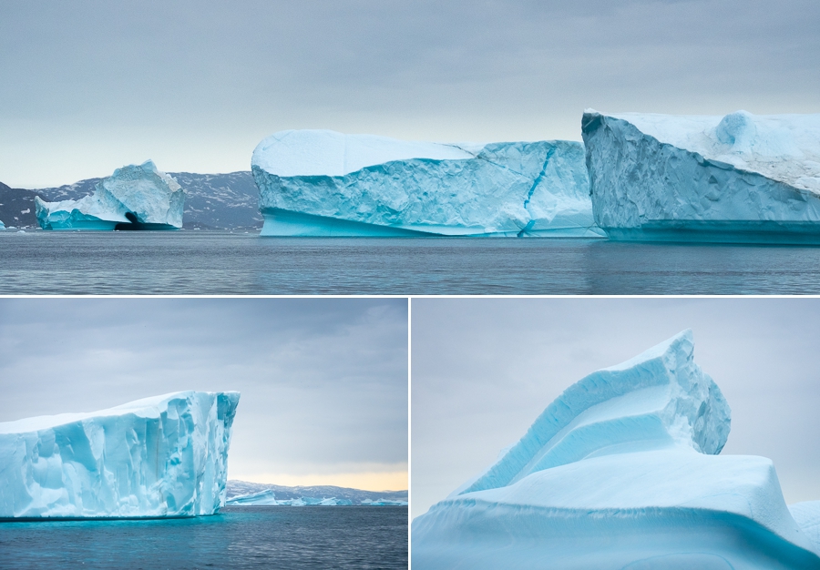
so I could enjoy the cold 😊 No, actually, so I could take pictures of the very large icebergs we were passing on our way down the Sermilik Fjord.
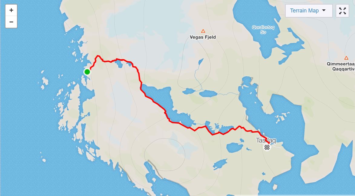
Our drop-off point was on the opposite side of Ammassalik Island to our final destination for the day – Tasiilaq. Lars would continue with our gear and drop it at our accommodation in East Greenland’s largest town (2000 people), while we hiked all the way across the southern part of the Island.
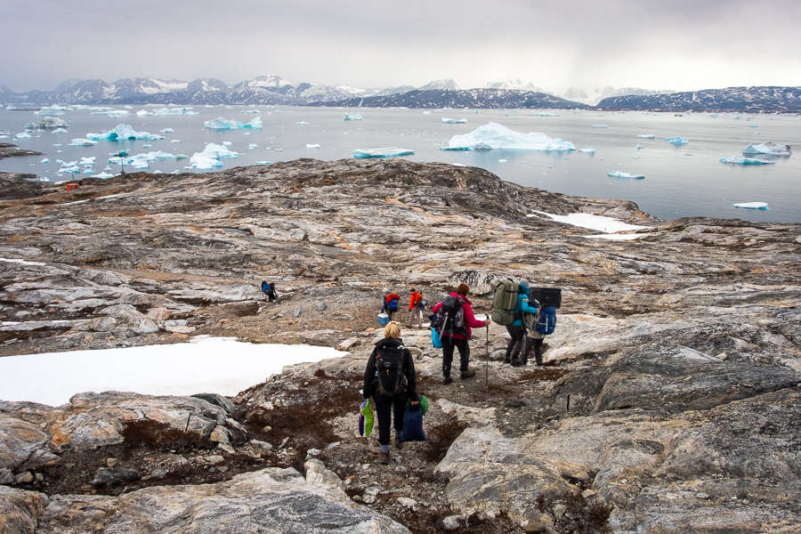
The first challenge – getting off the boat! We nosed into some rocks and Eric and Allan clamboured ashore to hold the rocking boat as firmly as possible while the rest of us negotiated the slippery seaweed and the steep but short climb to the start of the hike.

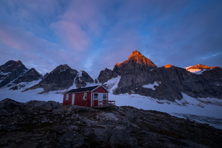
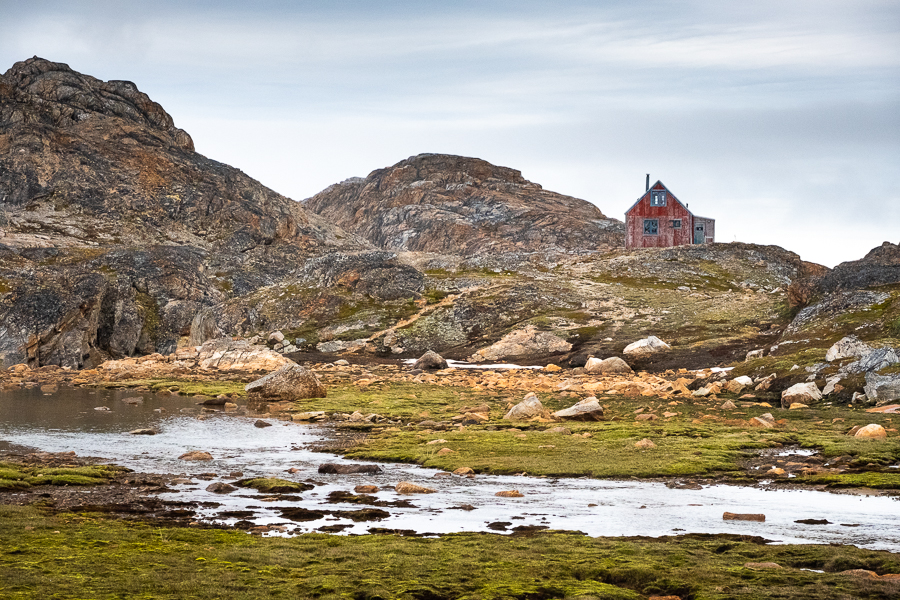
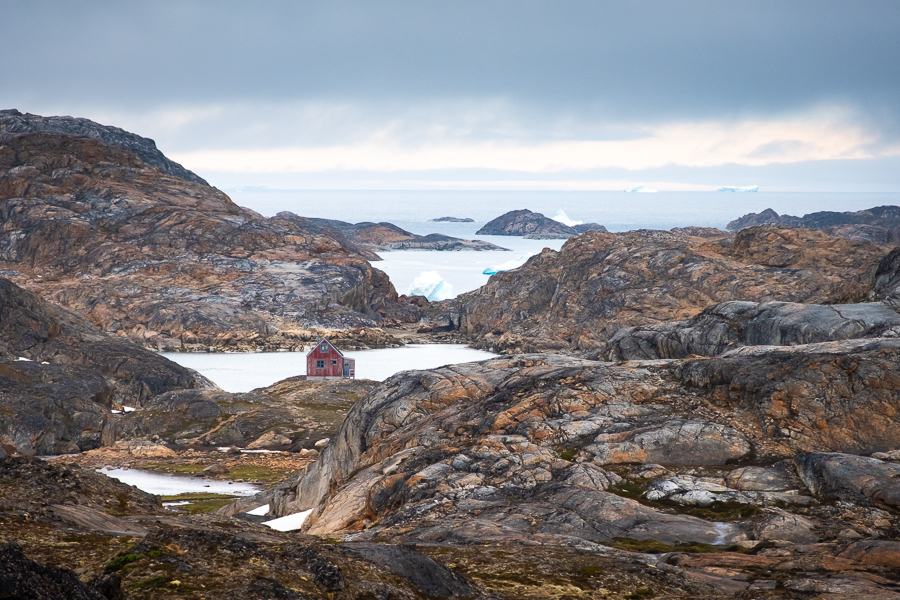
We passed by a red hut that is occasionally used by school groups
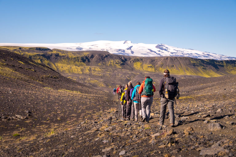
and followed the river up towards the pass.
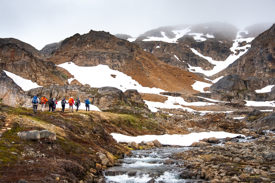
There were many beautiful waterfalls along the way

spectacular views back down over the fjord
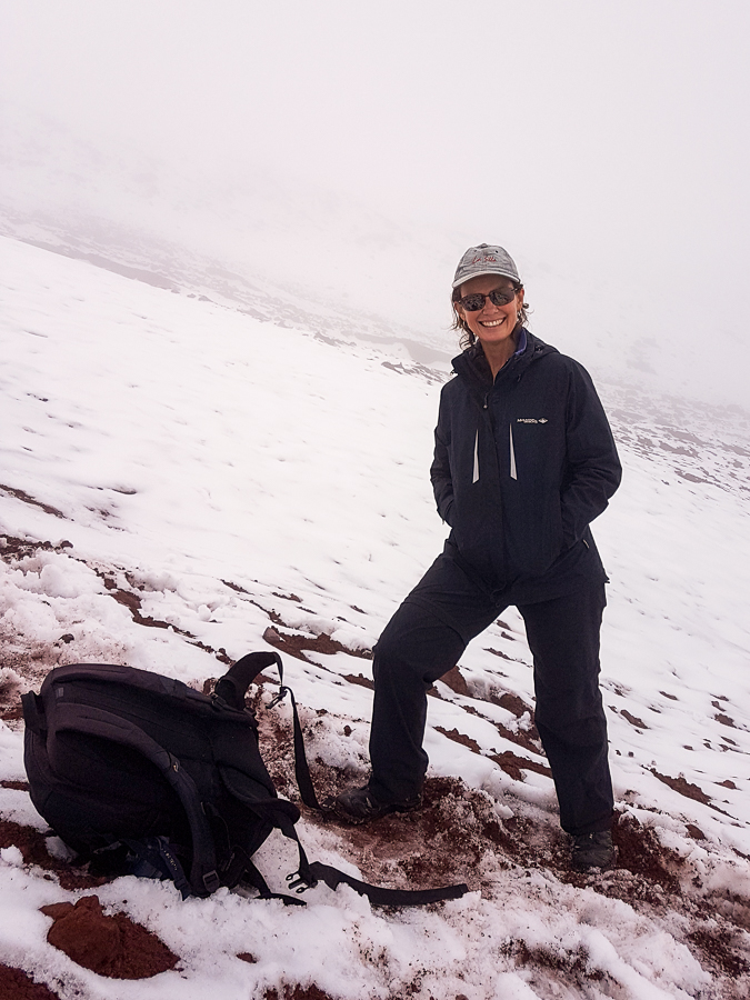
and, of course, snow 😊 Lots of snow!
It was absolutely stunning! One of my favourite day-hikes in East Greenland to date. Made even more beautiful (I suspect) by the surprisingly large amount of snow still on the ground for this time of year.
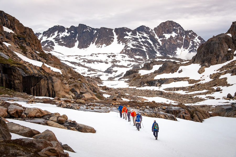
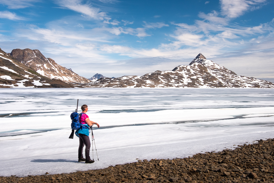
It took us quite a while to make our way around a large, still-mostly-frozen lake

and climb the snow-covered 400m pass

for an amazing view down to the extremely long Lake 168. Yes, really. That is what the lake is called!

We stopped here for “1st-lunch” and I decided to join Rhonda (a keen flora photographer) in taking photos of the lichen and plant life in the area. Greenland has a surprisingly large number of wildflowers, and the variety of lichens is amazing.

The other side of the pass turned out to be largely free of snow and very steep.
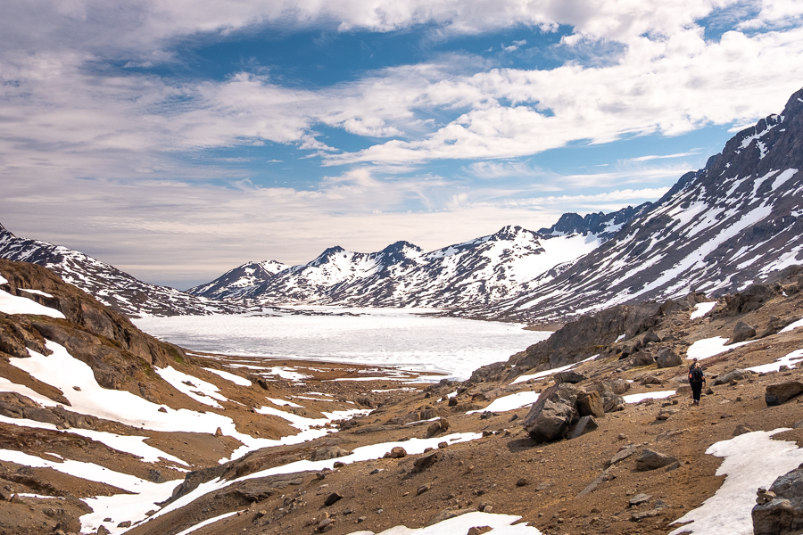
However, we all made it safely to the frozen shore of Lake 168 and went a bit berko taking photos of this incredible scene.

Andrea had warned us that “Lake 168 is the lake that seems to never end”, and while the unbelievably picturesque views kept us in awe for the first hour
we were all starting to wonder whether we’d ever reach the end of it during the second hour of hiking, as we negotiated sand, bogs, streams and, of course, snow. “2nd-lunch” kept us walking, however, and we did eventually pass beyond it.

The landscape became less frozen as we made our way closer to Tasiilaq, though there was still plenty of ice in the string of lakes (Lake 101, Lake 100 – no, seriously!) that bordered the route we were following.

Eventually we found ourselves at the end of a dirt road (a surprise in East Greenland) which we followed for the final few kilometres into town

and our very nice accommodation at one of the houses owned by Lars’ company Arctic Dream. My first shower in 9 days … heaven!

Read more about the Icefjords and Remote Villages Tour
If this post has piqued your curiosity about hiking and trekking in East Greenland, read about the rest of my adventure on the 10-day Icefjords and Remote Villages tour with Greenland Adventures:
- Day 1 – Kulusuk
- Day 2 – Hike to DYE-4 radar station
- Day 3 – Kulusuk to Kuummiut
- Day 4 – Hike to Illitsiartik in the Tunu fjord
- Day 5 – Hike up Mt Kuummiut
- Day 6 – Kuummiut to Tiniteqilaaq
- Day 7 – Hike near Tiniteqilaaq
- Day 8 – Tiniteqilaaq to Tasiilaq, hiking the “Sermilik Way”
- Day 9 – Tasiilaq
- Day 10 – Tasiilaq to Reykjavik
If it has sparked an interest in Greenland more generally, learn more about this amazing country at Visit Greenland, and check out the wide range of tours of all kinds (not just hiking and trekking) at Guide to Greenland.
Hiking Information
Distance = 19.5 km
Time taken = 8 hours 30 minutes
Strava Link = https://www.strava.com/activities/1704299055
Map
Altitude Profile