Hiking Greenland – Icefjords and Remote Villages – DYE-4
The great weather continued for Day 2 for the Icefjords and Remote Villages tour in East Greenland, and I was super-excited that I might finally make it to the former DYE-4 radar station! Unfortunately my attempt to hike out there last year failed due to bad weather.
While Bluie East Two (which I visited last year on Day 5 of the Unplugged Wilderness Trek) is a left-over from World War II, DYE-4 was part of the Distant Early Warning Line established during the Cold War. And although we’d been told that little of the original installation remained, I was still curious to see it. Plus, its location on a mountain at the southern end of Kulusuk Island promised great views over the Atlantic ocean – weather cooperating!
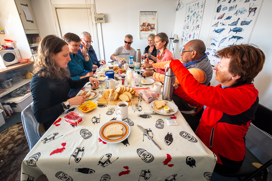
After an 8am breakfast where we could choose from toast (yay! I get excited about simple things) with all manner of spreads, muesli, porridge, tea and coffee, we each made a packed lunch for the day from an equally lavish spread of breads, cheese (brie, blue, Havarti), processed meats, tomato and cucumber. You don’t go hungry on an Greenland Adventures trip to East Greenland!
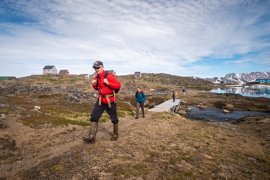
We then set off across a partially deconstructed bridge in the bright sunshine.
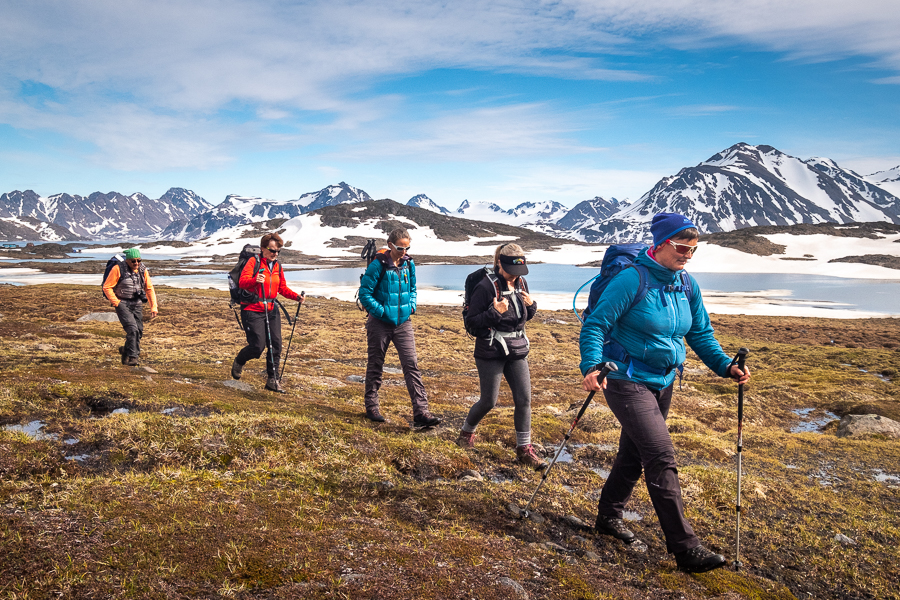
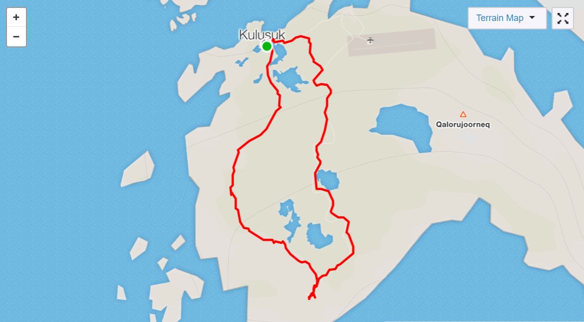
Rather than walking out and back along the (boring) road that runs all the way to the facility, we hiked without a trail towards the West coast of Kulusuk Island.
After about 45 minutes, we came to a line of large stones with a gap in the middle, located in a relatively clear patch of ground between two small hills. The remains of a Reindeer Fence.
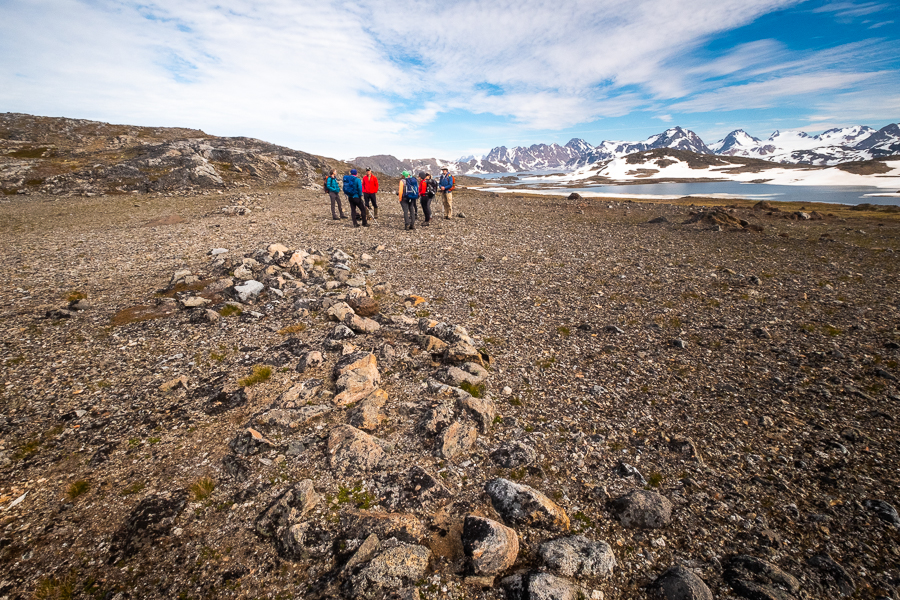
Andrea explained that the Greenlanders would “hunt” the reindeer by chasing them towards the gap in the fence. Their colleagues would hide behind the stone wall and kill the beasts as they ran through unaware. This was clearly an effective strategy as there are no reindeer remaining on Kulusuk Island!
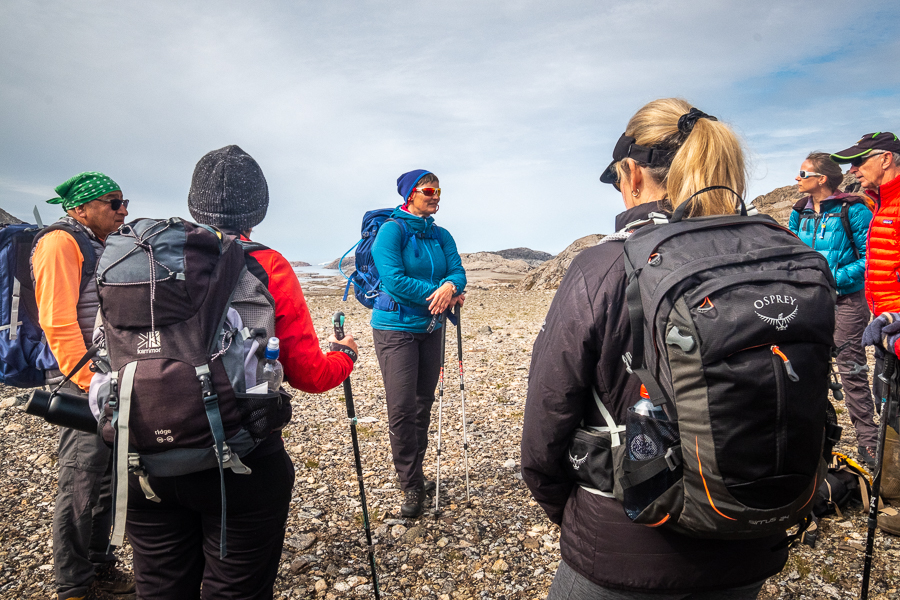
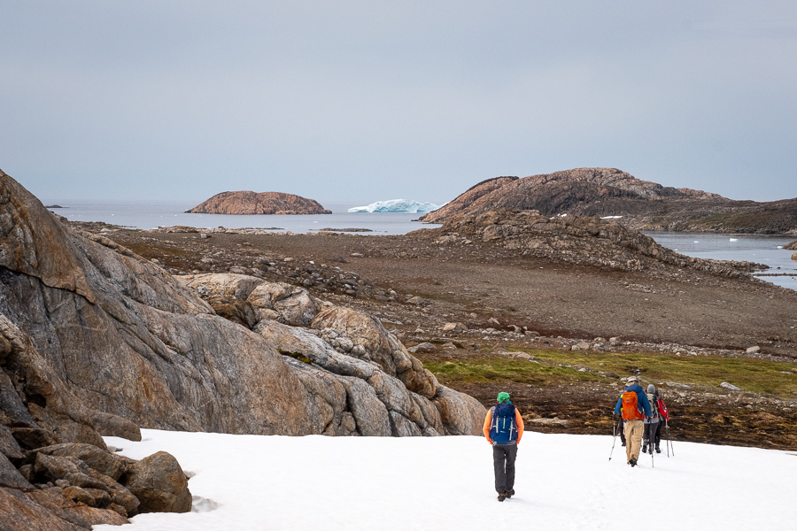
We continued our hike to the West, picking our way across boggy ground and snow drifts in turn.

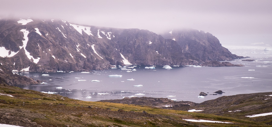
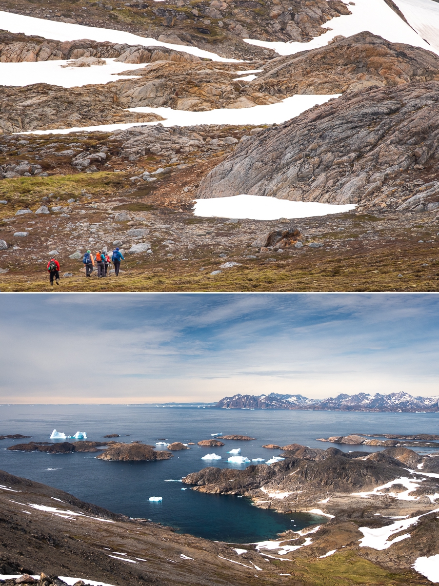
I loved the views of the large icebergs and almost invisible horizon line of the ocean ahead of us.

Once we reached the coast, we turned South and started skirting around the rocky mountain we’d been following. I loved this part of the hike! Icebergs and ocean to our right, the ever-impressive and interesting Greenlandic rock to our left, and an amazing view back down over the whole lot behind us.
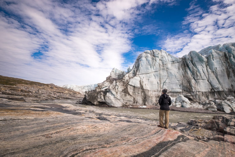
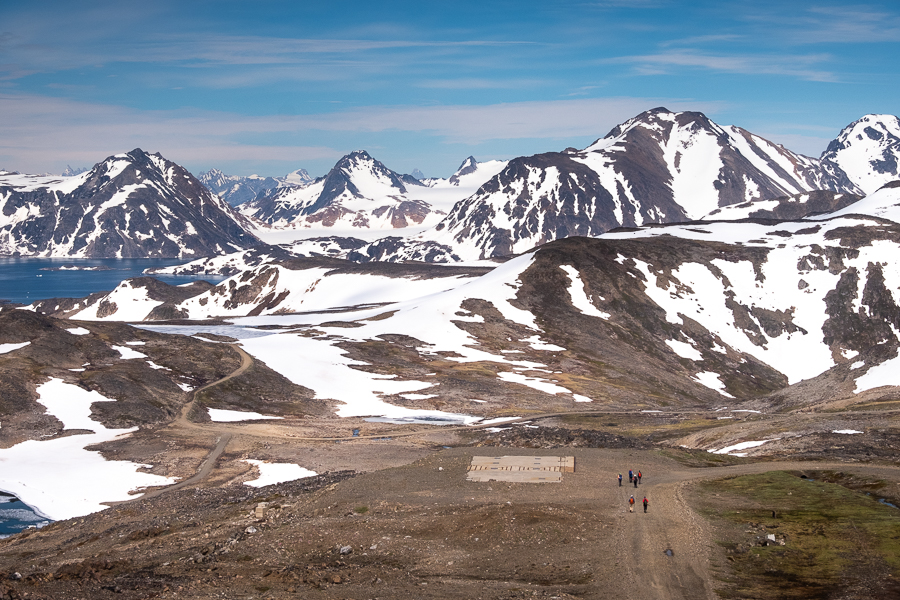
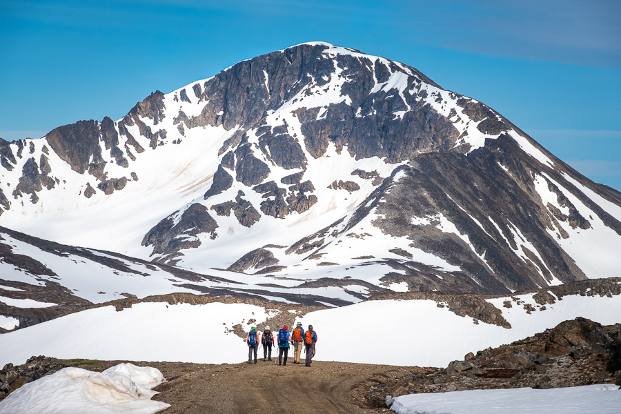
In front of us, DYE-4 appeared on the mountain top
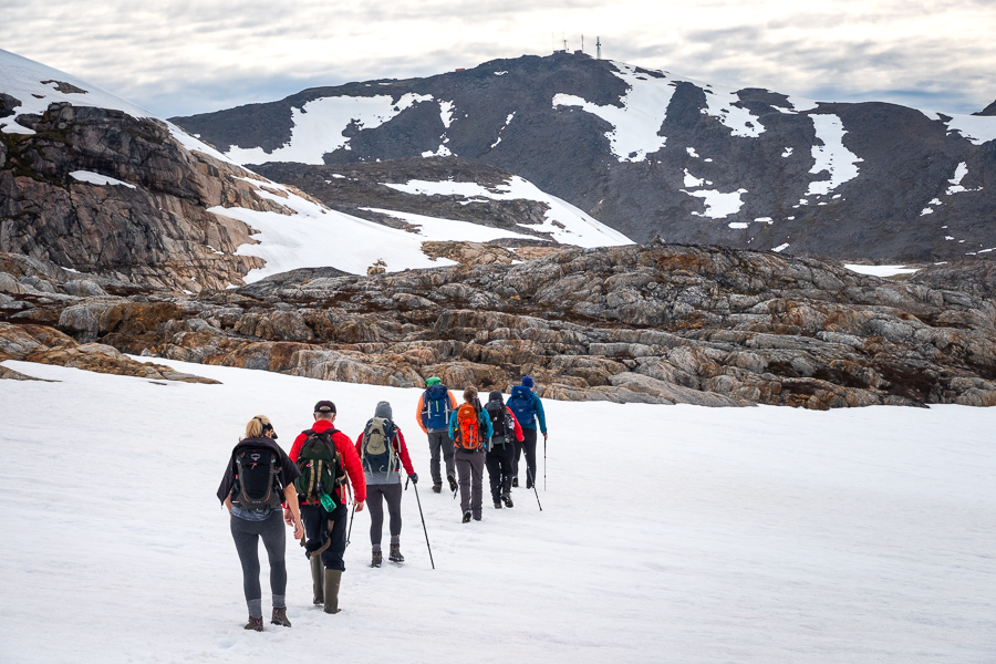
and as we climbed the rather steep slope, the views became more and more spectacular.

[move cursor over image to see full panorama]
As promised, there was little left of the original radar station at the site – the cold war defenses replaced by modern telecommunications antennas.

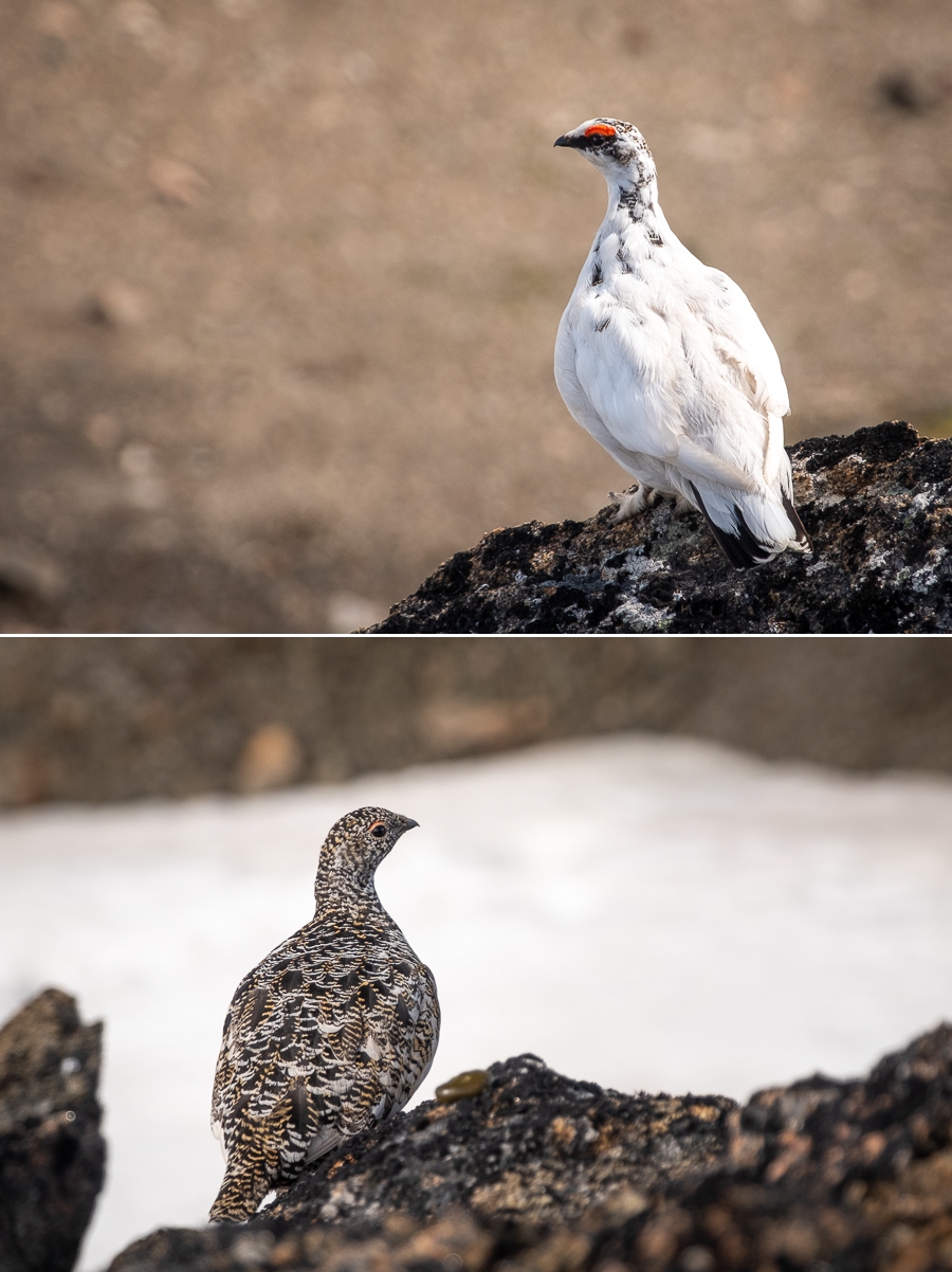
However we did spy this ptarmigan pair on our way to a very special lunch spot that Andrea had “reserved” for us. I was particularly excited to see these birds as I actually know the word for ptarmigan in Greenlandic (go figure)! Aqisseq is one of the roughly 150 Greenlandic words I currently have in my vocabulary – it is a tough language to learn!
Given the day was so amazing, we spent about an hour relaxing, soaking up the sun and enjoying the amazing view of the icebergs floating in the ocean

before starting our descent past the abandoned foundations of buildings to the road leading back to Kulusuk.
To be honest, I’m not a fan of hiking along roads, and this one was no exception (especially since I’d hiked 3/4 of it last year). However, we had a great view of the mountain that stands behind Kulusuk airport, the shape of which has given both the town and the island their name. Kulusuk = “chest of a black guillemot” in Greenlandic, where a guillemot is a black bird.
We wove our way between semi-frozen lakes that this time last year were completely ice free (it’s been a long, cold winter this year in Greenland)

and were rewarded with amazing views over the village of Kulusuk, the fjord and the mountains as we hiked the final kilometres into town.

[move cursor over image to see full panorama]
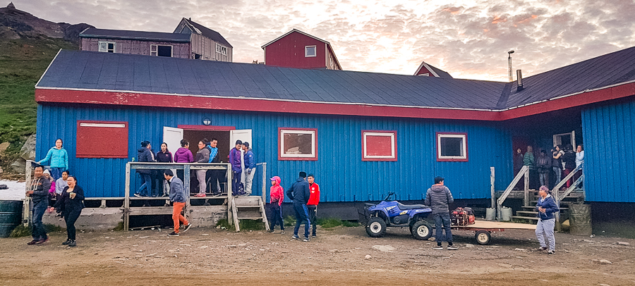
We all sat out on the deck of the Kulusuk hostel basking in the warm sunshine, drinking tea and eating leftover chocolate cake, before being called in for a dinner of prawn cocktail breads, Greenlandic lamb chops and roast veggies, and rice “pancakes” for dessert (we had loads of rice left over from last night’s dinner after all).

After dinner and instructions for the next day, everyone headed to bed. However, we’d been told about a live band playing in the local community hall that night starting at 10pm, so I decided to head on over there by myself.
I’m so glad I did! The band was made up of local musicians (e.g. the guy who runs the “service house” in Kulusuk was one of the guitar players), and was actually pretty good! There weren’t a lot of people when I first arrived, but within a minute of sitting down, 3 Greenlandic girls who were dressed to the absolute nines in tight black lacy dresses got me up to dance with them. Love these experiences!
The music was a mixture of slower songs, rock, and fast country, with the most popular being the fast country. Every time the band launched into one of these songs, all the girls in the room would hit the dance floor, pair up, and spin and turn together in what almost seemed to be a “standard” dance that everyone knew.
They were so energetic about it, and there were older women as well as the younger girls flinging themselves around the room. Awesome to watch, and I really, really wanted to join in – it looked like so much fun!
At about midnight, the band took a break, and I walked out to the statue of Milka Kuitse to take in the sunset. It was so peaceful and so beautiful, and I was so thankful to be back in Greenland 🙂 Oh how I love this place!

[move cursor over image to see full panorama]
Read more about the Icefjords and Remote Villages Tour
If this post has piqued your curiosity about hiking and trekking in East Greenland, read about the rest of my adventure on the 10-day Icefjords and Remote Villages tour with Greenland Adventures:
- Day 1 – Kulusuk
- Day 2 – Hike to DYE-4 radar station
- Day 3 – Kulusuk to Kuummiut
- Day 4 – Hike to Illitsiartik in the Tunu fjord
- Day 5 – Hike up Mt Kuummiut
- Day 6 – Kuummiut to Tiniteqilaaq
- Day 7 – Hike near Tiniteqilaaq
- Day 8 – Tiniteqilaaq to Tasiilaq, hiking the “Sermilik Way”
- Day 9 – Tasiilaq
- Day 10 – Tasiilaq to Reykjavik
If it has sparked an interest in Greenland more generally, learn more about this amazing country at Visit Greenland, and check out the wide range of tours of all kinds (not just hiking and trekking) at Guide to Greenland.
Hiking Information
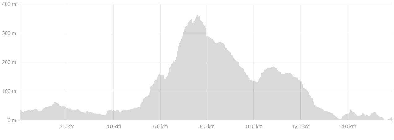
Distance = 15.9km
Time taken = 7 hours 17 minutes
Strava Link = https://www.strava.com/activities/1704297204
Map
Altitude Profile