Hiking Ecuador – Fuya Fuya
Along with Volcán Pasachoa, the other mountain that for some reason I desperately wanted to climb while living in Ecuador this year was Fuya Fuya. It was actually for this reason that I decided to base myself in Otavalo for a week – the Cascada de Peguche, Laguna Cuicocha and the Día de los Difuntos were just bonuses 🙂
Unfortunately, it is quite difficult to find other people who want to hike to the summit of a 4,200m mountain, especially when it turns out that Otavalo is very quiet outside of the two main market days (Wednesday and Saturday) and very, very few tourists actually stay there (they tend to do day tours from Quito). So in the end, I sprung for the whole taxi fare to take me to the trail-head and hiked on my own.

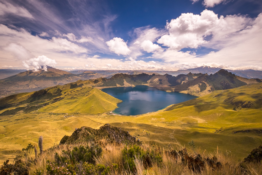
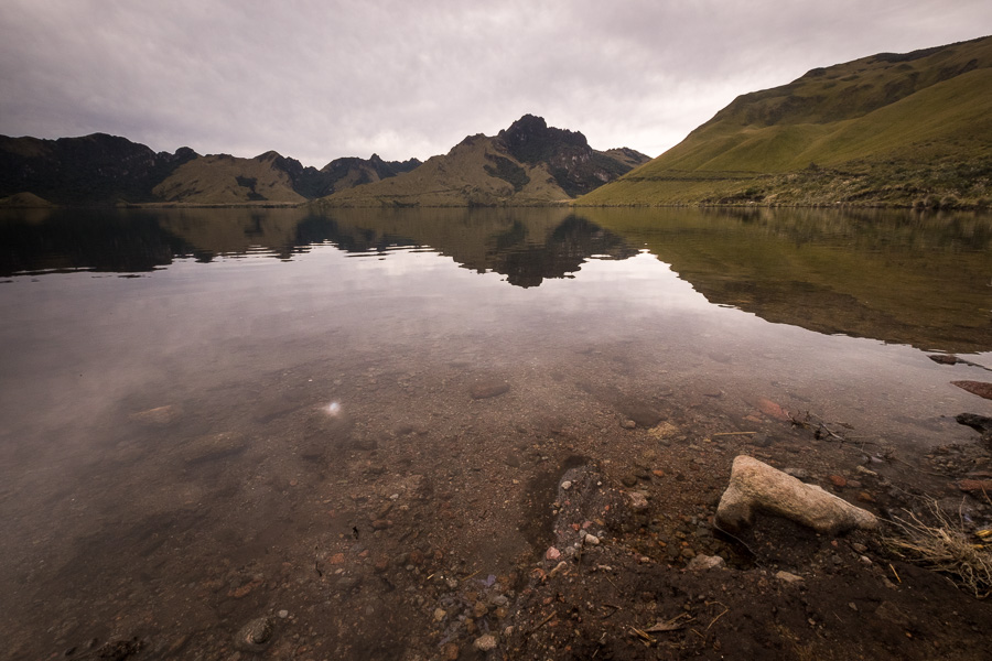
I started out early, hoping that I could reach the summit of Fuya Fuya before the clouds obscured everything and the rain came. 40 minutes later, the taxi had delivered me to Laguna Caricocha, which is one of the Mojanda Lakes and the starting point for the hike.
From there, I took a straight shot up a very steep hill, which turned out not to be the main trail after all.
In fact, I was about 2/3 the way up to the summit of Fuya Fuya (not the top of this first hill) before I managed to make my way across to the main hiking trail. And although I probably made things way harder for myself by bush-bashing through the páramo, it was all good – I was heading in the right general direction.
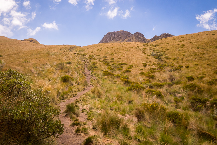
As always, the views were stunning.

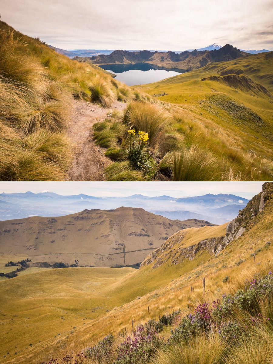
And were made even more special when I starting coming across wildflowers in the steep upper reaches of the climb.
Fuya Fuya actually has two peaks, and I’d been told to make sure I took the right hand route (which is slightly lower) once I got to the saddle point. This is because there is a tall rock that needs to be scaled if you take the left hand route. I ended up hiking along the ridge to the left-hand side just to see, but the infamous rock was very visible and very obviously not doable without equipment (or a death wish).

So I backtracked and headed for the right hand peak, which itself had a smaller rock that needed to be scaled and which I admit gave me a brief pause.

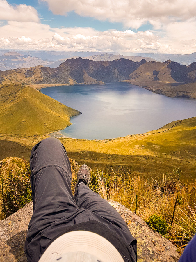
But the views were totally worth it!

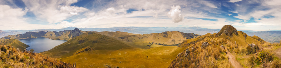
As you can see, the weather improved enormously while I was hiking and by the time I got to the summit, it was absolutely incredible. I pulled out another wonderful App I have called Peakfinder, and could see Cotocatchi, Cayambe, Antisana, and Cotopaxi, with a glimpse of the Chimborazo volcano on the horizon. All the snow-capped volcanoes were a little disguised by the background cloud, but their peaks were clearly visible when I first arrived.
It was so beautiful, and such a lovely day, that I ended up finding a rock to stretch out on and just stayed up here for a couple of hours admiring the view. Really – it doesn’t get much better than this!

Eventually the wind picked up and the clouds started to come over, so I decided to make my way back down the other trail. Apparently this is actually the main route to the top – the one with the signs (well, sign) I’d read about on the internet.

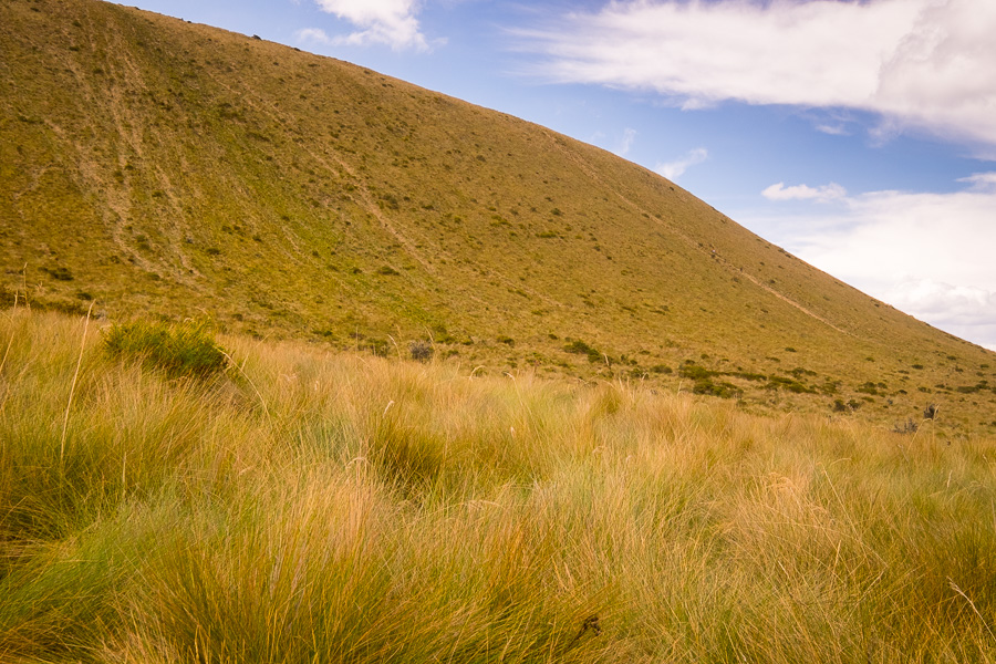
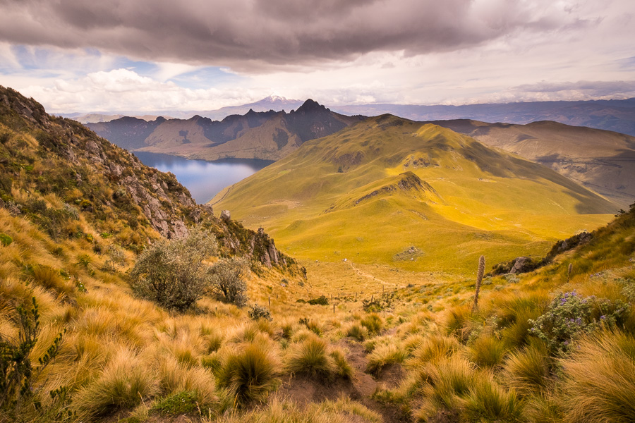
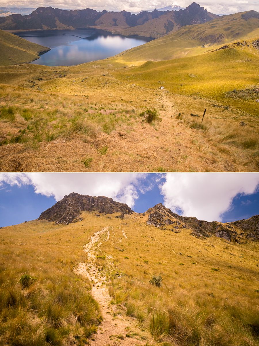
This whole hike is just spectacular páramo scenery.
The descent was also incredibly steep, and, just like on Pasochoa, I ended up grabbing fistfuls of páramo grass to help me descend. However, at some point I realised that the route I was taking looked like (and was as slippery as) a giant, grass slippery dip… And so yes, I actually decided to slide, rather than walk down 🙂
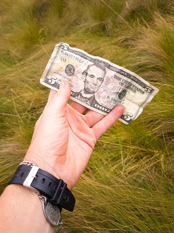
I ended up with hiking pants and undies full of páramo, but I also managed to find $5 – undoubtedly dropped by someone else who had had the same idea!
From there it was an easy hike back down the actual trail to the Mojanda Lakes.
My original plan was to hike all the way around the Mojanda lakes as well, but given that I ended up spending so much time stretched out on the rock at the summit, I didn’t have time before my taxi returned to collect me.
I did, however, manage to do a quick hike along the road out to the base of Cerro Negro and the turnoff to Laguna Chiriacu before having to turn back.

Overall, it was an incredible hike and I’m so grateful for the amazing weather I ended up having! Definitely a highlight!
Recommendation
If you like hiking, this is a great acclimatization climb that is not technical at all (well, except for that rock). Especially if you have good weather! In order to also hike the Mojanda Lakes after climbing Fuya Fuya, I would suggest you ask your taxi driver to pick you up at the end of the road near Laguna Huamicocha, rather than where he drops you off near Laguna Caricocha – that way you don’t have to back-track.
Cost: I just used a taxi arranged by my hostel for USD$30. He collected me at the hostel when I asked, and returned to collect me at Laguna Caricocha at the requested time for this price.
Time: To climb Fuya Fuya takes about 3 hours. I spent about 6 hours out here and wished I’d stayed 8.