Hiking Iceland – In the Shadow of Vatnajökull – Day 1
My trip to East Iceland started out a little too early in the morning and I’m thankful for 2 things:
- the fact that it never gets dark here in the summer makes it easier to drag oneself out of bed at 5:30am
- I’m staying very close to Reykjavik domestic airport and didn’t have to get up even earlier
Daniel, the Icelandic Mountain Guides representative, met myself, Eric and Melinda (from the US) at the airport to ensure we had everything and there were no issues, and I promptly fell back to sleep for the 50 minute Air Iceland Connect flight to Egilsstaðir as soon as I was clipped into seat 1C. I’ve never sat in the first row in a plane before!
We arrived on time and were met off the plane by Þorbjörg Þorvaldsdóttir. I’m terrible with names in the first place, and Icelandic place and people names are really challenging me! But thankfully she explained “just think of Thor and then the famous Icelandic singer, Björk, and put them together”. Ah! That made it very easy 🙂 And I learned that the Icelandic letter “Þ” is pronounced essentially like “th” in English!
The airport was actually the meeting place for the whole group, and we soon met Wolfgang and Sabine (a couple from Germany), Martin and Wolf (father and son from Germany), and Maria (from France). Introductions done, we did a pitstop at the local Nettó supermarket for fresh supplies for the next 4 days, made our lunch on the picnic table near the carpark, dropped off some luggage that would be transferred to the end of the hike for us, and then were on our way to the start point of our trek.
We had all signed up for the 4-day lightweight-backpacking trek: “In the Shadow of Vatnajökull” in East Iceland. The name aptly describes the trek, which travels down the remote eastern edge of Europe’s largest glacier – Vatnajökull. The “lightweight backpacking” part meant that although we would be staying in huts where sleeping bags and mats were provided and where Icelandic Mountain Guides had food caches, we would need to carry our clothing, sleeping bag liner, anything else we deemed essential, and a portion of the fresh food for the 4 day trek.
It was a pretty grey old day with low clouds, so there were not many views as we traveled firstly along the edge of a fjord and then up to a higher plateau in the direction of Mt Snæfell (“The Snow Mountain”), the highest mountain in Iceland outside of a glacier region.

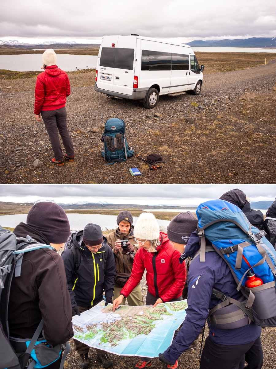
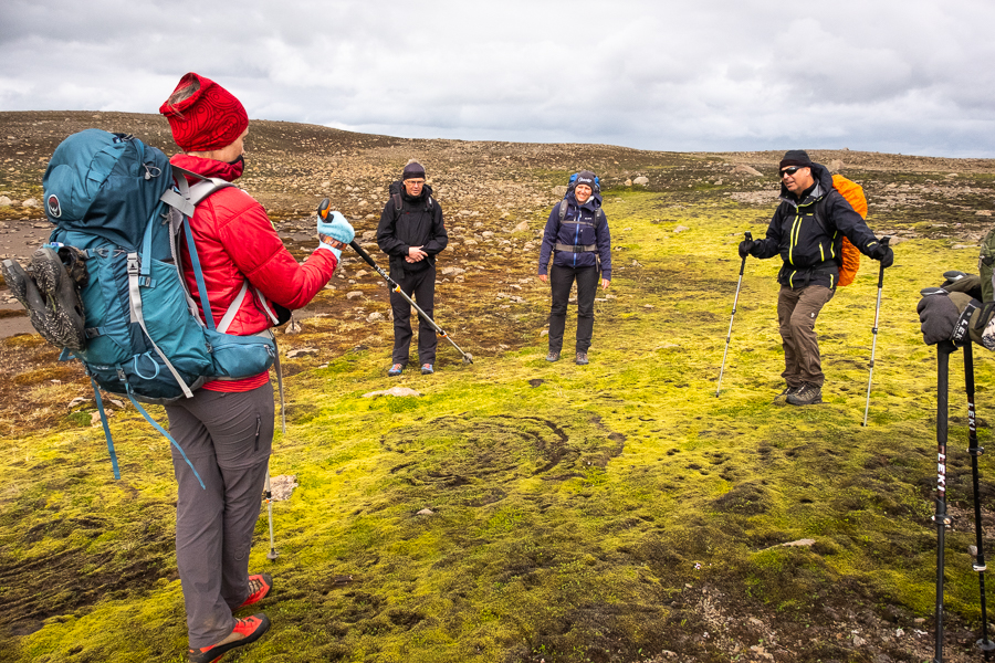
After about an hour, our driver pulled off to the side of the road and stopped. Once we’d all piled out with our gear, he promptly took off back the way we’d come, leaving us standing in what seemed to be the middle of nowhere. Þorbjörg quickly assured us that it was all good, and pulled out the map to show us the plan for today and the next 3 days.
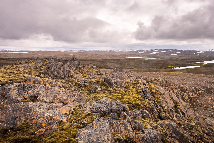
We then set off across rocky, unmarked land (there was no trail to follow) as we hiked along the edge of one of Iceland’s many water storage dams.

One of the most impressive features we came across in this rather flat terrain was a rocky outcrop that allowed us a slightly elevated view of the landscape. We managed to find a spot that was more-or-less protected from the wind to have lunch, and Þorbjörg surprised us with a snack of Kleiner – yummy Icelandic donuts.

Despite our relatively sheltered position, it was quite cold. So after I hurriedly ate my sandwich, I kept myself moving by taking photos of the surroundings
and all the nearby wildflowers. There were quite a few!

We were slowly making our way towards one of the glacier tongues of Vatnajökull, at the base of which sat our home for the evening – Geldingafell Hut.

But before we arrived, we started to come across swathes of bright green moss growing in the wetter areas of the lava field. Its vividness amidst the almost monochrome volcanic rock was startling and I loved how it held the water droplets so carefully in its embrace.

Unfortunately, not all was well with parts of this green carpet, and Þorbjörg also pointed out some “witches circles” caused by a fungus that attacks the moss in a circular pattern.
Those who have been following my hiking adventures in Patagonia, Iceland and Greenland know how much I “love” cold river crossings. Day 1 placed two of these in our path. But now I have my neoprene socks – I have no fear! 🙂

There were a few small snow drifts to navigate (nothing compared to what we had on the Icefjords and Remote Villages trek in East Greenland) on the final uphill to the hut, and Þorbjörg welcomed us to our home for the night by tasking us with opening all the shutters that protect the windows from wild weather.
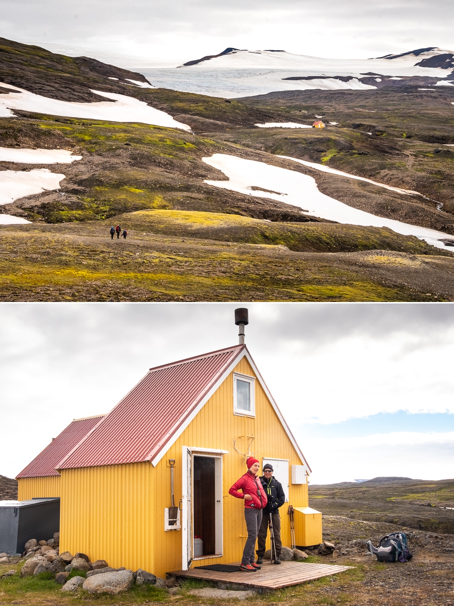
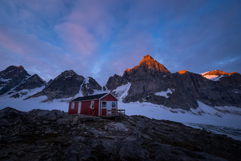
Geldingafell Hut is very small and cosy inside – especially for 9 people. There is nowhere really to sit except for on the bunks, which is why we were all very happy that the skies finally cleared and the Sun started shining brightly just after we arrived!

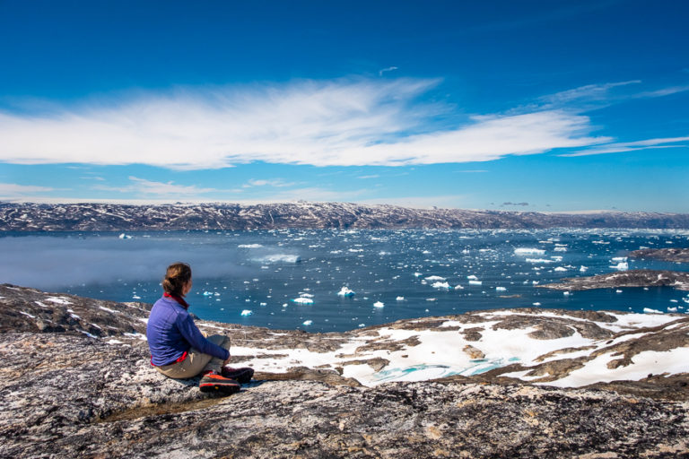
I decided to go for a short hike up the hill behind the hut before dinner to get a clearer view of the glacier and epic views back down over the hut and the valley below it.

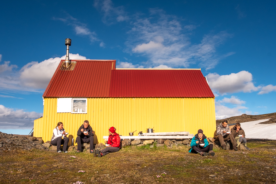
And arrived back just in time for our al fresco dining for the evening – minestrone soup and spaghetti bolognaise 🙂 We all enjoyed sitting outside in the warm sunshine, but eventually had to retreat inside as the Sun approached the horizon and the temperature dropped.
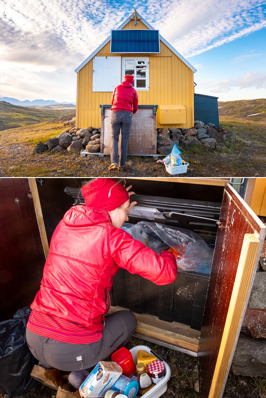
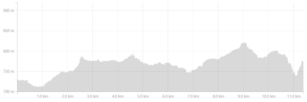
For dessert, Þorbjörg “went shopping” for us in the Icelandic Mountain Guides “store” out the back of the hut. Because of the remoteness of this hut, the company estimates how many trekkers they will have during the summer and caches enough dry/tinned food during the winter (when they can access the hut by snowmobile) to cover their estimate. The logistics for some of their treks are really impressive!
Sitting on our beds, we downed chocolate cake, Jägermeister (thanks to Wolfgang and Sabine – no Wolfgang – half a glass does not constitute “the smallest amount possible just for a taste”), and hot chocolate before most people turned in for the night. I stayed up a little longer to catch a beautiful sunset at around 11:30pm, and then followed suit.

Trekking Information
Distance = 11.39km
Time taken = 5 hours 07 minutes
Map

Altitude Profile
Read more about hiking In the Shadow of Vatnajökull
If this post has piqued your curiosity, read about the rest of the 4-day trek “In the Shadow of Vatnajökull” with Icelandic Mountain Guides
- Day 1 – to Geldingafell Hut
- Day 2 – from Geldingafell Hut to Egilssel Hut
- Day 3 – from Egilssel Hut to Múlaskáli Hut
- Day 4 – from Múlaskáli Hut to Höfn
Alternatively, check out my other posts about hiking and trekking in Iceland and around the world.